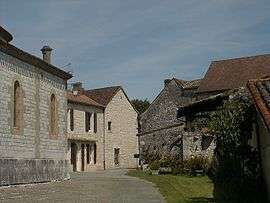
Saint-Cernin-de-Labarde
| Saint-Cernin-de-Labarde | |
|---|---|
 | |
 Saint-Cernin-de-Labarde | |
|
Location within Nouvelle-Aquitaine region  Saint-Cernin-de-Labarde | |
| Coordinates: 44°45′54″N 0°34′23″E / 44.765°N 0.5731°ECoordinates: 44°45′54″N 0°34′23″E / 44.765°N 0.5731°E | |
| Country | France |
| Region | Nouvelle-Aquitaine |
| Department | Dordogne |
| Arrondissement | Bergerac |
| Canton | Issigeac |
| Government | |
| • Mayor (2008–2014) | Vianney d'Hautefeuille |
| Area1 | 11.39 km2 (4.40 sq mi) |
| Population (2008)2 | 198 |
| • Density | 17/km2 (45/sq mi) |
| Time zone | CET (UTC+1) |
| • Summer (DST) | CEST (UTC+2) |
| INSEE/Postal code | 24385 / 24560 |
| Elevation |
52–133 m (171–436 ft) (avg. 100 m or 330 ft) |
|
1 French Land Register data, which excludes lakes, ponds, glaciers > 1 km² (0.386 sq mi or 247 acres) and river estuaries. 2 Population without double counting: residents of multiple communes (e.g., students and military personnel) only counted once. | |
Saint-Cernin-de-Labarde is a commune in the Dordogne department in Nouvelle-Aquitaine in southwestern France.
Population
| Historical population | ||
|---|---|---|
| Year | Pop. | ±% |
| 1962 | 227 | — |
| 1968 | 223 | −1.8% |
| 1975 | 201 | −9.9% |
| 1982 | 197 | −2.0% |
| 1990 | 231 | +17.3% |
| 1999 | 243 | +5.2% |
| 2008 | 198 | −18.5% |
See also
References
| Wikimedia Commons has media related to Saint-Cernin-de-Labarde. |
This article is issued from Wikipedia - version of the 11/9/2016. The text is available under the Creative Commons Attribution/Share Alike but additional terms may apply for the media files.