Pike County Airport (Ohio)
| Pike County Airport | |||||||||||
|---|---|---|---|---|---|---|---|---|---|---|---|
| IATA: none – ICAO: KEOP – FAA LID: EOP | |||||||||||
| Summary | |||||||||||
| Airport type | Public | ||||||||||
| Owner | Pike County Airport Authority | ||||||||||
| Serves | Pike County, Ohio | ||||||||||
| Location | Waverly, Ohio | ||||||||||
| Elevation AMSL | 660 ft / 201 m | ||||||||||
| Coordinates | 39°10′01″N 082°55′41″W / 39.16694°N 82.92806°W | ||||||||||
| Website | Pike County Airport | ||||||||||
| Map | |||||||||||
 EOP  EOP Location of airport in Ohio/United States | |||||||||||
| Runways | |||||||||||
| |||||||||||
| Statistics (2009) | |||||||||||
| |||||||||||
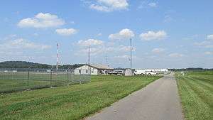
Pike County Airport (ICAO: KEOP, FAA LID: EOP) is a county-owned, public-use airport located three nautical miles (3.5 miles; 5.6 km) northeast of the central business district of Waverly, a village in Pike County, Ohio, United States.[1] This airport is included in the FAA's National Plan of Integrated Airport Systems for 2011–2015, which categorized it as a general aviation facility.[2]
Although many U.S. airports use the same three-letter location identifier for the FAA and IATA, this facility is assigned EOP by the FAA but has no designation from the IATA.[3]
Facilities and aircraft
Pike County Airport covers an area of 70 acres (28 ha) at an elevation of 660 feet (201 m) above mean sea level. It has one runway designated 7/25 with an asphalt surface measuring 4,900 by 75 feet (1,494 x 23 m).[1]
For the 12-month period ending June 30, 2009, the airport had 2,012 aircraft operations, an average of 167 per month: 99% general aviation and 1% military. At that time there were six single-engine aircraft based at this airport.[1]
References
- 1 2 3 4 FAA Airport Master Record for EOP (Form 5010 PDF). Federal Aviation Administration. Effective 30 June 2011.
- ↑ National Plan of Integrated Airport Systems for 2011–2015: Appendix A (PDF, 2.03 MB). Federal Aviation Administration. Updated 4 October 2010.
- ↑ "Pike County Airport (FAA: EOP, ICAO: KEOP)". Great Circle Mapper. Retrieved 2 July 2011.
External links
- PikeCountyAirport.wordpress.com
- Aerial photo as of 23 March 1994 from USGS The National Map
- FAA Terminal Procedures for EOP, effective December 8, 2016
- Resources for this airport:
- FAA airport information for EOP
- AirNav airport information for EOP
- FlightAware airport information and live flight tracker
- SkyVector aeronautical chart for EOP