Piz Lagrev
| Piz Lagrev | |
|---|---|
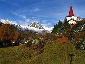 View from the Maloja Pass | |
| Highest point | |
| Elevation | 3,165 m (10,384 ft) |
| Prominence | 855 m (2,805 ft) [1] |
| Parent peak | Piz Platta |
| Coordinates | 46°26′45.6″N 9°43′25.2″E / 46.446000°N 9.723667°ECoordinates: 46°26′45.6″N 9°43′25.2″E / 46.446000°N 9.723667°E |
| Geography | |
 Piz Lagrev Location in Switzerland | |
| Location | Graubünden, Switzerland |
| Parent range | Albula Alps |
| Climbing | |
| First ascent | 9 October 1875 by L. Held and Moritz Arpagaus |
Piz Lagrev is a mountain of the Albula Alps, overlooking Lake Sils in the Swiss canton of Graubünden. On its northern side lies the Julier Pass. Reaching a height of 3,165 metres (10,384 feet) above sea level, Piz Lagrev is the culminating point of the range lying between the Septimer Pass and the Julier Pass.
Northeast of Piz Lagrev is a small glacier named Vadret Lagrev and an unnamed lake at its bottom.
References
- ↑ Retrieved from the Swisstopo topographic maps. The key col is the Septimer Pass (2,310 m).
External links
 Media related to Piz Lagrev at Wikimedia Commons
- Piz Lagrev on Hikr
- Piz Lagrev on Summitpost
This article is issued from Wikipedia - version of the 5/9/2016. The text is available under the Creative Commons Attribution/Share Alike but additional terms may apply for the media files.