Plaitford
| Plaitford | |
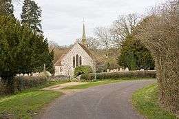
 St Peter's Church |
|
 Plaitford |
|
| Population | 352 |
|---|---|
| OS grid reference | SU2785519329 |
| District | Test Valley |
| Shire county | Hampshire |
| Region | South East |
| Country | England |
| Sovereign state | United Kingdom |
| Post town | ROMSEY |
| Postcode district | SO51 6 |
| Police | Hampshire |
| Fire | Hampshire |
| Ambulance | South Central |
| EU Parliament | South East England |
| UK Parliament | North West Hampshire |
Coordinates: 50°58′22″N 1°36′17″W / 50.972705°N 1.60465°W
Plaitford is a small village and civil parish in the Test Valley district of Hampshire, England. Its nearest town is Romsey, which lies approximately 4.9 miles (7.8 km) east from the village and adjacent to the large village of West Wellow. It formed part of Wiltshire until 1895, when it was transferred to Hampshire.[1][2]
The original village of Plaitford, lies to the north of the River Blackwater (River Loddon), but the chief part of the population is now located near the A36 road, which crosses the parish from east to west. Plaitford Green is a small district in the north of the parish.[3] Plaitford Common, which occupies the southern portion of the parish, consists chiefly of rough grass land and is owned by the National Trust.[4]
