Pomonkey, Maryland
| Pomonkey, Maryland | |
|---|---|
| Unincorporated community | |
 Pomonkey  Pomonkey Location within the state of Maryland | |
| Coordinates: 38°36′28″N 77°04′18″W / 38.60778°N 77.07167°WCoordinates: 38°36′28″N 77°04′18″W / 38.60778°N 77.07167°W | |
| Country | United States |
| State | Maryland |
| County | Charles |
| Time zone | Eastern (EST) (UTC-5) |
| • Summer (DST) | EDT (UTC-4) |
| GNIS feature ID | 586633 |
Pomonkey is an unincorporated community located in Charles County, Maryland at the crossing of Livingston Road and Pomfret Road, one mile (1.6 km) from Bryans Road.[1][2][3][4]
History
Pomonkey is named for the Pamunkey tribe of Native Americans that lived in the area. Dating from the early 19th century, the village of Bumpy Oak was renamed to Pomonkey when it was designated a postal stop.[5] The former Pomonkey High School was one of two black segregated high schools in Charles County until the 1960s, and has a proud alumni association.[6] From 1946 to 1970 the "Pomonkey Spoon Factory" manufactured wooden tools and small items.[7] For several years, Maryland Airport has planned a 1,300 ft (400 m) expansion, including an energetics (explosives) technical center and business park employing over 3,000 people, but the plans are currently delayed by environmental concerns related to stormwater discharge into Mattawoman Creek.[8] The Naval Research Laboratory has its Free Space Antenna Range on Bumpy Oak Road.
Demographics
Pomonkey itself is a rural area, for which few statistics are available. Bryans Road, Maryland is the nearest community to Pomonkey for which data are available.[9] However, the area lies at the meeting of ZIP codes 20616 (Bryans Road), 20640 (Indian Head) and 20646 (La Plata).[10] As of 2000, Election District 7 (named for Pomonkey, but which includes Bryans Road and Indian Head)[1] had a population of 11,859 persons. The racial breakdown was: 59.0% white, 35.8% black, 1.5% American Indian and Alaskan Native, 1.2% Asian, 0.1% Asian Indian, 0.2% Chinese, 0.6% Filipino, <0.1% Japanese, 0.1% Korean, <0.1% Vietnamese, 0.1% Other Asian, 0.1% Native Hawaiian and other Pacific Islander, 0.5% Other race, 1.8% two or more races.[11]
Local landmarks
- J.C. Parks Elementary School
- Maryland Airport[12]
- Matthew Henson Middle School
- Saint Johns Cemetery
- Saint Johns Chapel[13]
References
- 1 2 "Bryans Road Indian Head Sub-Area Plan". Charles County, Maryland — Department Of Planning & Growth Management. Retrieved 2007-10-14. Page 19.
- ↑ "Pomonkey Map". Absolute United States. Retrieved 2008-02-19.
- ↑ "Routes 220-239". MDRoads. Retrieved 2008-02-19. Contrast with the Pomonkey Map, and see that the note for Route 227 refers to Marshall Hall road, which differs from Marshall Corner road.
- ↑ U.S. Geological Survey Geographic Names Information System: Pomonkey, Maryland
- ↑ Bryans Road, Appendix B Appendix B Brief History of Bryans Road
- ↑ Partlow, Joshua; Paley, Amit R. (February 17, 2005). Area's Black Schoolhouses Still Have a Lesson to Teach. The Washington Post. Retrieved 2007-12-23.
As noted here, the other school was Bel Alton. - ↑ "Portraits of America: Charles County", page 55 of volume 2, published 2009.
- ↑ Maryland Independent newspaper, October 30, 2009, page A-8.
- ↑ "20616 Zip Code (Bryans Road, Maryland) Detailed Profile". City-data.com. Retrieved 2008-01-04.
- ↑ "Charles County, Maryland 2002 Zip Code Areas" (PDF). Maryland State Data Center. Retrieved 2008-01-04.
- ↑ Pomonkey
- ↑ AirNav Information
- ↑ Pomonkey, Maryland, United States
External links
- Describes former NRL installation
- Pomonkey Launch and Control (MD-217/218, W-54)
- "Bryans Road Indian Head Sub-Area Plan". Department Of Planning & Growth Management, Charles County, Maryland. Retrieved 2007-12-22.
- Dents Level Cemetery
- Philip Rucker (July 22, 2007). "After a Long Wait, Charles Airport to Expand". The Washington Post. Retrieved 2007-12-22.
- "Inside Our School World, Sports: African Americans During a Century of Segregation, Charles County, Maryland". College of Southern Maryland. 2007-07-20. Retrieved 2007-12-22.
Municipalities and communities of Charles County, Maryland, United States | ||
|---|---|---|
| Towns | 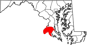 | |
| CDPs | ||
| Other communities | ||