Port Beaufort
| Port Beaufort | |
|---|---|
|
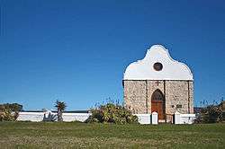
Barry Church, Port Beaufort | |
 Port Beaufort  Port Beaufort  Port Beaufort
| |
| Coordinates: 34°23′45″S 20°49′25″E / 34.39583°S 20.82361°ECoordinates: 34°23′45″S 20°49′25″E / 34.39583°S 20.82361°E | |
| Country | South Africa |
| Province | Western Cape |
| District | Eden |
| Municipality | Hessequa |
| Area[1] | |
| • Total | 2.71 km2 (1.05 sq mi) |
| Population (2011)[1] | |
| • Total | 321 |
| • Density | 120/km2 (310/sq mi) |
| Racial makeup (2011)[1] | |
| • Black African | 9.7% |
| • Coloured | 2.2% |
| • White | 87.2% |
| • Other | 0.9% |
| First languages (2011)[1] | |
| • Afrikaans | 72.3% |
| • English | 26.0% |
| • Other | 1.6% |
Port Beaufort is a settlement in Eden District Municipality in the Western Cape province of South Africa.
Seaside resort, formerly also a harbour, on the north bank of the Breede River estuary. The settlement was named after Henry Somerset, 5th Duke of Beaufort, the father of Lord Charles Somerset.[2]
References
- 1 2 3 4 "Main Place Port Beaufort". Census 2011.
- ↑ Raper, R.E. Dictionary of Southern African Place Names. Human Sciences Research Council (South Africa).
This article is issued from Wikipedia - version of the 10/2/2016. The text is available under the Creative Commons Attribution/Share Alike but additional terms may apply for the media files.

.svg.png)