Port Dickson District
| Port Dickson District | |||
|---|---|---|---|
 | |||
| |||
|
Nickname(s): PD 波德申 | |||
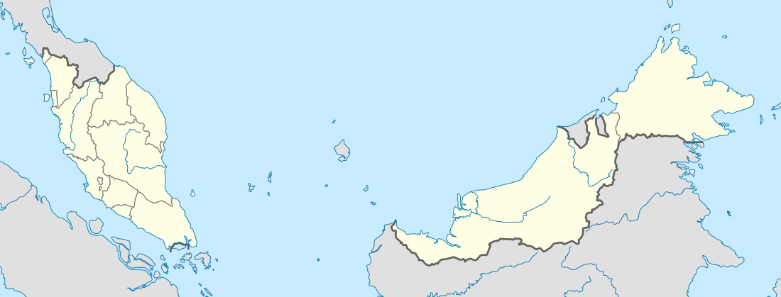 Port Dickson District Location of Port Dickson in Peninsular Malaysia | |||
| Coordinates: 2°31′N 101°48′E / 2.517°N 101.800°E | |||
| Country |
| ||
| State |
| ||
| Established | 1800s | ||
| Population (2007) | |||
| • Total | 97,834 | ||
| Time zone | MST (UTC+8) | ||
| • Summer (DST) | Not observed (UTC) | ||
| Postcode | 71xxx | ||
| Website | Port Dickson Municipal Council | ||
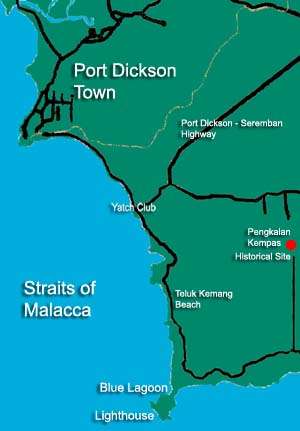
Port Dickson (Chinese: 波德申), or PD to locals, is a coastal town, a district and an upcoming parliamentary constituency in Negeri Sembilan, Malaysia. It takes just over an hour by car to travel from Kuala Lumpur to Port Dickson along the North-South Expressway.
History
This small town used to produce charcoal and therefore was called Arang (Malay: "charcoal") - there used to be a carbon mine at the first mile of the coast road (hence named Jalan Pantai) - but it was later developed as a small port by the British during the Straits Settlement period. Port Dickson was also known as Tanjung (Malay: "cape"). The oldest shophouses were the four situated presently at Jalan Lama.
Historically what is today Port Dickson and nearby Lukut were part of Selangor. On 30 July 1880, a meeting was held in Singapore between Sultan Abdul Samad (then Sultan of Selangor), Raja Bot (the ruler of Lukut district), Dato' Kelana of Sungai Ujong as well as the British, in which Selangor cedes the district of Lukut to Sungai Ujong (which later became Negeri Sembilan).[1][2]
Tin ore was plentiful in Lukut, an area within the Port Dickson district, during the 1820s, and it attracted Chinese immigrant miners. The British considered the area to have great potential as a harbour. It was intended to supersede the port in Pengkalan Kempas. The in-charge officer's name was Dickson, and thereafter the town was named Port Dickson. Others claim that Sir John Frederick Dickson, colonial secretary,[3] a senior official of the Federated Malay States founded Port Dickson and Pulau Arang in 1889.[4]
Port Dickson evolved into a busy trading centre. Railways were constructed to facilitate the growth and development of Port Dickson. Although Port Dickson experienced rapid development, the beautiful beaches are fairly well preserved. Now, Port Dickson has become not only a beautiful tourist destination, but a large municipality with about 524,076 residents.
Port Dickson is also home to many army camps of the Malaysian Army such as Sebatang Karah, Segenting, Si Rusa and Sunggala.[5] In September 2009, Prime Minister Datuk Seri Najib Tun Razak declared Port Dickson as an "Army Town" in recognition of her role in the nation's military services.[6]
Economy
Oil and gas production
Port Dickson has two refineries which make significant contributions to the local economy. Shell Refining Company has been operating since 1962[7] while Petron (formerly ExxonMobil Malaysia) operates another refinery which began operation in 1963.[8]
Tourism
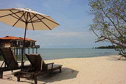
The 18 km extent of beach from Tanjung Gemuk to Tanjung Tuan is a popular holiday destination for local visitors, especially those who come from Kuala Lumpur. Many Singaporeans have invested in holiday homes in and around Port Dickson. Over the years, many hotels and resorts were opened to capitalize on the tourist draw. In the 1990s, Port Dickson boomed with new hotels and resorts being planned and constructed. Due to the Asian financial crisis of 1997 however, many of these projects stalled, leaving many unfinished buildings scattered along the Port Dickson coastline. While some of these half constructed resorts are still abandoned, with the improving economy of the 2000s many of the projects were eventually revived and completed.


Yacht clubs
Linking the Indian and Pacific Oceans, the Straits of Malacca is the shortest sea route between three of the world's most populous countries - India, China, and Indonesia. Inspired by the sea trade, expats founded the Royal Port Dickson Yacht Club in 1927, which still offers dinghy sailing courses and runs regattas. Unknown to most, Malaysia's developmental sailing teams, starting at the Optimist Dinghy level, train in and sail from the RPDYC Politeknik Port Dickson.
The newer 5-star Admiral Marina & Leisure Club has good dock facilities for yacht travelers, sailboats and luxury cruisers. It is a transit point for racing sailboats joining the Raja Muda Selangor International Regatta, Royal Langkawi International Regatta and Thailand's Phuket Kings Cup regattas. Admiral Marina also hosted the disabled sailing event of the 2009 ASEAN Para Games and the 2006 FESPIC Games.[9]
Commerce
As of 2016, there around 8 shopping centres in the town that serve its population.
Administrative divisions
Port Dickson District is divided into 5 mukims, which are:[10]
- Jimah
- Linggi
- Pasir Panjang
- Port Dickson
- Si Rusa
Politics
The district is represented in the Dewan Rakyat of the Malaysian Parliament as the Telok Kemang constituency. It is currently represented by Kamarul Baharin Abbas of PKR.[11]
In turn, Telok Kemang contributes 5 seats to the Negeri Sembilan State Legislative Assembly:
Lukut is currently held by Ean Yong Tin Sin of the DAP; Chuah and Port Dickson are held by PKR, and the remaining two seats, Bagan Pinang and Linggi, are currently controlled by UMNO.[12]
Following a September 2016 re-delineation exercise, the Port Dickson name was used for the whole parliamentary constituency replacing Telok Kemang, while the boundaries remain unchanged.
Townships in Port Dickson districts
- Linggi
- Permatang
- Pengkalan Kempas
- Bukit Kempas
- Teluk Kemang
- Pasir Panjang
- Pantai Cermin
- Bandar Sunggala
- Sirusa
- Siliau
- Lukut
- Kuala Lukut
- Kota Lukut
- Bukit Palong
- Jimah
- Bandar Springhill
Transportation
Car
Port Dickson is easily accessible from most major towns of peninsular Malaysia. The SPDH ![]() (operated by PLUS) or the old federal highway
(operated by PLUS) or the old federal highway ![]() connects Port Dickson to Seremban, the state capital.
connects Port Dickson to Seremban, the state capital.
Highway ![]() runs through downtown Port Dickson and links it to Malacca and then Johor Bahru due south, or Kuala Langat, Klang or even Ipoh due north.
runs through downtown Port Dickson and links it to Malacca and then Johor Bahru due south, or Kuala Langat, Klang or even Ipoh due north.
Public transportation
There is a 39 km-long branch line of the KTMB network linking Port Dickson to Seremban, but the line is currently disused since 2008. There though are plans to reuse the line for freight and passenger services.[13]
References
- ↑ "Lukut asalnya adalah kawasan Selangor". DUN N26 Bangi, Selangor. Retrieved 14 October 2015.
- ↑ "Perjanjian Sempadan Negeri Selangor dan Sungai Ujung 1880". Wangsa Mahkota Selangor. Retrieved 14 October 2015.
- ↑ The Knights of England
- ↑ Strategic Marketing: An Introduction, By Tony Proctor. Page 214
- ↑ "Malaysia's own Fort Knox". New Straits Times. 2012-06-16. Retrieved 2012-06-16.
- ↑ PD now known as Army Town
- ↑ "Shell Refinery Celebrates 50 Years With The Community - Shell Refining Company". Shell.com. Retrieved 2013-11-11.
- ↑ "Petron Malaysia". Petron.com.my. Retrieved 2013-11-11.
- ↑ Inaugural sailing event in FESPIC Games held at Admiral Marina
- ↑ http://apps.water.gov.my/jpskomuniti/dokumen/JPS@KOMUNITI%20SG.JIMAHPROFIL-2011.pdf
- ↑ "Ahli Parlimen". Portal Rasmi Parlimen Malaysia. Retrieved 24 January 2016.
- ↑ "Senarai ADUN Barisan Nasional". Barisan Nasional. Retrieved 24 January 2016.
- ↑ "Seremban-Port Dickson railway line to be rebuilt". The Star Online. Retrieved 24 January 2016.
External links
- Tourism Malaysia - Port Dickson Beach
 Port Dickson travel guide from Wikivoyage
| Wikimedia Commons has media related to Port Dickson. |
Coordinates: 2°31′N 101°48′E / 2.517°N 101.800°E
