Port of Magdalla
| Port of Magdalla | |
|---|---|
| port town | |
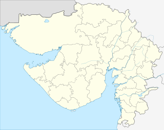 Port of Magdalla  Port of Magdalla Location in Gujarat, India | |
| Coordinates: 21°05′N 72°39′E / 21.08°N 72.65°ECoordinates: 21°05′N 72°39′E / 21.08°N 72.65°E | |
| Country |
|
| State | Gujarat |
| District | Surat |
| Talukas | Choryasi |
| Government | |
| • Body | Gujarat Maritime Board |
| Area | |
| • Total | 3.12 km2 (1.20 sq mi) |
| Elevation | 6 m (20 ft) |
| Population (2008) | |
| • Total | 14,500 |
| • Density | 4,600/km2 (12,000/sq mi) |
| Languages | |
| • Official | Gujarati, Hindi |
| Time zone | IST (UTC+5:30) |
| PIN | 395007 |
| Telephone code | 0261 |
| Vehicle registration | GJ-5 |
| Nearest city | Udhana |
| Civic agency | Gujarat Marinetime Board |
| Distance from Udhana | 16 kilometres (9.9 mi) (land) |
| Distance from Surat | 18 kilometres (11 mi) NE (land) |
| Distance from Sachin | 19 kilometres (12 mi) SE (land) |
| Website |
gujaratindia |
The Port of Magdalla is a port located on the western shores of India in southern Gujarat, on the southern bank of the Tapti river. A deep water anchorage is located 10 nautical miles (19 km) southwest from the port. It is connected with Udhana GIDC and Pandesara Industrial Estate which is about 12 kilometres (7.5 mi) away. The port is connected with Surat by state highway No.66. An airport is located 3 kilometres (1.9 mi) from the port. Magdalla Port is also well connected by road and rail with several other towns in the area.
History

After bifurcation of Mumbai State in 1960 the committee for development of Intermediate Ports recommended for the development of Magdalla Port site for cargo operation by carrying out required necessary dredging and creating necessary landing place and support fleet and infrastructure facilities taking into account the growth of Udhana as an Industrial area. Magdalla Port was opened out in 1966 as an intermediate Port during which year the port has handled Bananas as export cargo and fertilizers, foodgrain as Import cargo.
In 1979 Kakarapar and Ukai Dam was constructed on Tapti River. Thereafter, in 1979–80, M/s. Narmada Cement Co. Ltd., was established. Magdalla Port came into operation from 1982.
Tidal information
(spring tide ) in mtr. (Year - 2012)
High Water Low Water
(a) Outer Hazira - (+) 8.43 (+) 0.36 (b) Inner Hazira — (+) 6.49 (+) 0.57 (c )Magdalla Port — (+) 5.11 (-) -0.14 Note:- The day to day predicted Tide Table Book is available with Port Office only.