Porter Ranch, Los Angeles
| Porter Ranch | |
|---|---|
| Neighborhood of Los Angeles | |
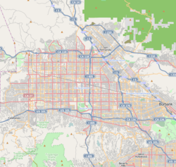 Porter Ranch Location within Los Angeles/San Fernando Valley | |
| Coordinates: 34°16′53″N 118°34′17″W / 34.28139°N 118.57139°W | |
| Country | United States |
| State | California |
| County | Los Angeles |
| City | Los Angeles |
| Elevation | 1,280 ft (390 m) |
| Population (2008 Los Angeles City Planner Estimate) | |
| • Total | 30,571 |
| Time zone | PST (UTC-8) |
| • Summer (DST) | PDT (UTC-7) |
| ZIP code | 91326 |
| Area code(s) | 818 |
Porter Ranch is an affluent neighborhood in the northwest region of the San Fernando Valley region of the city of Los Angeles, California.
Geography
Location
The neighborhood is bounded by Brown's Canyon/Chatsworth on the south and west, Northridge on the south, and Granada Hills on the northeast and east. The Santa Susana Mountains, which separate the San Fernando and Santa Clarita valleys, lie to the north. The principal thoroughfares are Mason Ave., Corbin Ave., Porter Ranch Drive, Tampa Ave. and Reseda Blvd., running north-south, and Sesnon Blvd., Rinaldi St. and the Ronald Reagan Freeway (State Route 118), running east and west. The Porter Ranch ZIP code is 91326.
Porter Ranch is in the hilly northwestern tip of the San Fernando Valley, where, according to a 2008 Los Angeles Times article, it was a "calm outpost of Los Angeles" that attracted residents "seeking sanctuary from the urban hubbub." It was noted that the neighborhood had "some of the cleanest air in the Valley year-around—some of which is attributable to winds that sweep through the community regularly." Nevertheless, "those same winds, which have been clocked at 70 mph, take down trees and holiday lights."[1]
Nearby places

History
New home building that eventually took place in the Porter Ranch area in the 1990s–2000s, including the Renaissance Summit development, was mired in controversy and Los Angeles politics in the late 1980s and early 1990s.[2] Existing residents of the Porter Ranch area feared the increased traffic that would be brought by the planned building of an area commercial complex to service the new homes being built.[3] Developments were also criticized for destroying the natural beauty of the brush and wild areas that inhabited the space before the houses were built.[4]
However, Shapell Homes, a company founded by Nathan Shapell, a major Los Angeles builder,[2][4][5] brought together powerful Los Angeles political figures to support the new home building.[2][4]
Aliso Canyon Bridge
In the late 80s, there was an attempt to connect Sesnon Boulevard, the road that flanks the north side of the neighborhood, to its counterpart across the Aliso Canyon, also named Sesnon, via a bridge to be named simply, the "Aliso Canyon Bridge". This plan never came to fruition due to demonstrations from the residents of Porter Ranch, the primary opponents of the bridge, who believed that connecting the road to the neighborhood across the canyon would bring "crime...drag racing, and drug dealing". Residents were also afraid of Sesnon becoming "a [highway] 118 alternate route", which would "send many cars through Porter Ranch".[6]
Proponents of the bridge said that there was a "critical need" to build a bridge because "the city of Los Angeles has installed heavy-duty guard rails to stop any vehicle that is out of control as it moves east at Beaufait. There is a much smaller rail 200 feet farther east...however, the first guard rail is usually partially broken because of out-of-control vehicles hitting it. Before it can be repaired, there is almost no protection to prevent a vehicle from falling into Aliso Canyon. Additionally, if a vehicle heading west on Sesnon becomes lost, there is no barrier to prevent it from falling into this deep canyon." Despite the proponents' argument about the severity of the situation, the bridge was never built.[7]
There is still evidence of the bridge seen from Sesnon heading east towards the canyon, the road (which is now closed off behind multiple guard rails) is visible heading towards the canyon just short of the bridge, and the counterpart is still visible on the west-bound side.
Gas blowout
On October 23, 2015, Southern California Gas Company workers discovered a leak in one of the over 110 wells at the Aliso Canyon natural gas storage facility, about one mile north of homes in Porter Ranch. The gas blowout began spewing 110,000 pounds of methane per hour. The blowout involved gas stored under pressure in an underground reservoir; the stored gas included mercapatan (tert-Butylthiol), an odorant added to the odorless natural gas to produce a "rotten egg" smell for safety.[8] The California Air Resources Board estimated that the leak increased California's methane-gas emissions by 25%.[9]
By order of the Los Angeles County Dept of Health, the company relocated thousands of families from the Porter Ranch area; the Federal Aviation Administration established a temporary flight restriction over the leak site until March 2016.[8] On December 15, the county of Los Angeles declared a state of emergency,[10] and two days later it approved a plan to close two schools in the area.[9] Officials estimated that the leak would take months to repair.[8]
On January 11, 2016 Mitchell Englander, the LA City Councilman representing Porter Ranch, said "Most people weren't aware that one of the largest gas storage facilities in the United States was in their backyard. There was, from what we're hearing, no disclosure when they bought their homes."[11]
On February 18, 2016, state officials announced that the leak was permanently plugged. [12]
On March 12, 2016, Los Angeles County Public Health Department officials say its test of dust in Porter Ranch homes turned up the presence of metals, including barium, that could have caused the kinds of health symptoms some residents have reported experiencing even after the big gas blowout was plugged. [13]
Population
According to the U.S. Census in 2000, the population was 24,923. Based on the Los Angeles Department of City Planning estimates, the population was 30,571 in 2008.[14]
With a population density of 4,462 people per square mile (1,723/km2), Porter Ranch is among the lowest-density neighborhoods of the city of Los Angeles, but the density is about average for the county.[14]
Ethnic makeup
According to Mapping L.A. of the Los Angeles Times, Porter Ranch was "moderately diverse," with a relatively high ratio of Asian and white people in the neighborhood. The figures for 2000 were 60.9% White, 26.8% Asian, 7.5% Latino, 1.8% black and 3.0% other races.[14]
A total of 8,385 (33.6%) of residents were foreign born, about average for both the city and the county. Korea (21.4%) and Philippines (9.3%) were the most common foreign places of birth.[14]
Household makeup
Average household size was three people, about the same as the rest of the city and county. Of the housing units in Porter Ranch, 91.8% were occupied by homeowners, while 8.2% were occupied by renters.[14]
Income
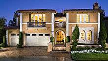
The median household income was $121,428 in 2008 dollars, a high figure for the city and the county. In Los Angeles County, Bel-Air, Hidden Hills and Rolling Hills had the most similar household incomes. The percentages of households that earn $60,000 and above were high for the county.[14] Porter Ranch is rated the wealthiest neighborhood in the San Fernando Valley, with Encino ranked second.[15]
Government and infrastructure
Local
Los Angeles Fire Department Station 8 and Station 28 are in the area.
Los Angeles Police Department operates from the nearby Devonshire Police Station.
County, state and federal
Porter Ranch is located in California's 25th congressional district, which is represented by Republican Steve Knight.
The Los Angeles County Department of Health Services operates the Pacoima Health Center in Pacoima, serving Porter Ranch.[16]
Porter Ranch is located in Los Angeles City Council District 12, currently represented by Mitchell Englander. It also is represented by the Porter Ranch Neighborhood Council.
The United States Postal Service Ranch Post Office is located at 19300 Rinaldi Street.[17]
Education
Fifty-one percent of Porter Ranch residents aged 25 and older had earned a four-year degree by 2000, a high percentage for the city.[14]
Schools
Schools within the Porter Ranch boundaries are:[18]
Public
- Castlebay Lane Charter School, 19010 Castlebay Lane
- Porter Ranch Community School, 12450 Mason Avenue
Private
There are no private schools within Porter Ranch.
Libraries
Los Angeles Public Library operates a branch library within the community.
Parks and recreation
Palisades Park is an unstaffed park in Porter Ranch.[19] Others include Aliso Canyon Park, Rinaldi Park, Viking Park, Porter Ridge Park, Limekiln Canyon Park, Moonshine Canyon Park, and Holleigh Bernson Memorial Park.[20] Porter Ridge Park was a filming location of the movie E.T. the Extra-Terrestrial (1982).[21]
See also
- Robert M. Wilkinson (ca. 1921–2010), Los Angeles City Council member and Porter Ranch lobbyist[22][23]
- Hal Bernson, Los Angeles City Council member, 1979–2003, when Porter Ranch development was approved[24][25]
- Renaissance Summit, a subdivision at the highest point of Porter Ranch
References
- ↑ "Wind-swept but comfy on L.A.'s fringe - latimes". Articles.latimes.com. 1999-01-24. Retrieved 2016-01-20.
- 1 2 3 Newman, Morris (August 17, 1999). "Porter Ranch Builder's Acts Speak Louder Than Words". Los Angeles Times. Archived from the original on January 25, 2012. Retrieved January 25, 2012.
- ↑ Nelson, Valerie J. (March 13, 2007). "Nathan Shapell, 85; builder who developed Porter Ranch was also noted philanthropist". Los Angeles Times. Archived from the original on January 25, 2012. Retrieved January 25, 2012.
- 1 2 3 Wilcox, Gregory J. (August 8, 1999). "Gate More Than Threshold to Luxury". Los Angeles Daily News. Archived from the original on January 25, 2012. Retrieved January 25, 2012.
- ↑ Griffiths, Connie (July 7, 2011). "On Campus: Stadium namesake was 'a builder of lives'". Orange County Register. Retrieved January 25, 2012.
- ↑ "LA Times-Aliso Canyon Bridge". Retrieved 24 July 2016.
- ↑ "LA Times-For an Aliso Canyon Bridge". Retrieved 24 July 2016.
- 1 2 3 "Here's what you need to know about the Porter Ranch gas leak". Los Angeles Daily News. 2015-12-11. Retrieved 2015-12-18.
- 1 2 Howard Blume (2015-12-17). "L.A. Unified will relocate Porter Ranch students and could sue over gas leak costs". Los Angeles Times. Retrieved 2015-12-18.
- ↑ Gregory J. Wilcox (2015-12-15). "LA County declares state of emergency over Porter Ranch gas leak". Los Angeles Daily News. Retrieved 2015-12-18.
- ↑ Steve Inskeep, Renee Montagne (11 January 2016). "LA Councilman Compares Porter Ranch Gas Leak To BP Oil Spill But On Land". Around the Nation. NPR.
- ↑ "Porter Ranch gas leak permanently capped, officials say". latimes.com. Retrieved 2016-02-18.
- ↑ http://www.scpr.org/news/2016/05/12/60583/porter-ranch-barium-and-other-metals-found-to-be-t/
- 1 2 3 4 5 6 7 "Porter Ranch Profile - Mapping L.A. - Los Angeles Times". Projects.latimes.com. Retrieved 2013-10-13.
- ↑ "Vacation Rentals, Homes, Apartments & Rooms for Rent - Airbnb". Nabewise.com. Retrieved 2013-10-13.
- ↑ "LA County Department of Public Health" (PDF). Publichealth.lacounty.gov. Retrieved 2016-01-20.
- ↑
- ↑ "Porter Ranch Schools - Mapping L.A. - Los Angeles Times". Maps.latimes.com. Retrieved 2016-01-20.
- ↑ "City of Los Angeles Department of Recreation and Parks". Laparks.org. Retrieved 2016-01-20.
- ↑ "Google Maps". Google.com. Retrieved 2016-01-20.
- ↑ Hervé Attia (2009-04-07). "On the Set of E.T". Onthesetofet.blogspot.com. Retrieved 2016-01-20.
- ↑ Nelson, Valerie J. (2010-10-01). "Robert M. Wilkinson dies at 89; longtime L.A. city councilman - Los Angeles Times". Articles.latimes.com. Retrieved 2013-10-13.
- ↑ http://search.proquest.com/docview/153158343
- ↑ Connell, Rich; Hill-Holtzman, Nancy (1991-04-11). "Growth Revolt Is a Factor : Development: Council members Hal Bernson and Ruth Galanter face June runoffs. Both had been broadly criticized for their policies on building. - Los Angeles Times". Articles.latimes.com. Retrieved 2013-10-13.
- ↑ http://search.proquest.com/docview/280869628/
External links
| Districts and neighborhoods |
|  |
|---|---|---|
| Points of interest | ||
| Neighboring cities and communities | ||
| Topics |  | |
|---|---|---|
| Government | ||