Potštát
| Potštát | |||
| Town | |||
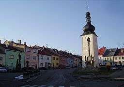 Town square | |||
|
|||
| Country | Czech Republic | ||
|---|---|---|---|
| Region | Olomouc | ||
| District | Přerov | ||
| Commune | Hranice | ||
| River | Velička | ||
| Elevation | 502 m (1,647 ft) | ||
| Coordinates | CZ 49°38′N 17°38′E / 49.633°N 17.633°ECoordinates: CZ 49°38′N 17°38′E / 49.633°N 17.633°E | ||
| Area | 34.11 km2 (13.17 sq mi) | ||
| Population | 1,214 (2006-07-03) | ||
| Density | 36/km2 (93/sq mi) | ||
| First mentioned | 1322 | ||
| Mayor | Alena Otáhalová | ||
| Timezone | CET (UTC+1) | ||
| - summer (DST) | CEST (UTC+2) | ||
| Postal code | 753 62 | ||
  Location in the Czech Republic | |||
| Wikimedia Commons: Potštát | |||
| Statistics: statnisprava.cz | |||
| Website: www.potstat.cz | |||


Potštát (Czech pronunciation: [ˈpot.ʃtaːt]; German: Bodenstadt) is a town in the Olomouc Region, Czech Republic. From 1938 to 1945 it was one of the municipalities in Sudetenland.
| Wikimedia Commons has media related to Potštát. |
This article is issued from Wikipedia - version of the 4/4/2016. The text is available under the Creative Commons Attribution/Share Alike but additional terms may apply for the media files.