Préizerdaul
| Préizerdaul | ||
|---|---|---|
| Commune | ||
| ||
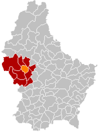 Map of Luxembourg with Préizerdaul highlighted in orange, and the canton in dark red | ||
| Coordinates: 49°47′39″N 5°56′15″E / 49.7942°N 5.9375°ECoordinates: 49°47′39″N 5°56′15″E / 49.7942°N 5.9375°E | ||
| Country |
| |
| Canton | Redange | |
| Government | ||
| • Mayor | Fernand Heyart | |
| Area | ||
| • Total | 15.6 km2 (6.0 sq mi) | |
| Area rank | 74 of 105 | |
| Highest elevation | 402 m (1,319 ft) | |
| • Rank | 48th of 105 | |
| Lowest elevation | 255 m (837 ft) | |
| • Rank | 61st of 105 | |
| Population (2014) | ||
| • Total | 1,574 | |
| • Rank | 82nd of 105 | |
| • Density | 100/km2 (260/sq mi) | |
| • Density rank | 61st of 105 | |
| Time zone | CET (UTC+1) | |
| • Summer (DST) | CEST (UTC+2) | |
| LAU 2 | LU00003002 | |
| Website | preizerdaul.lu | |

Préizerdaul is a commune in western Luxembourg, in the canton of Redange. Until 17 July 2001, it was known as Bettborn, after its administrative centre.[1] Préizerdaul was the first commune to change its name since before the First World War; to date, it is the only commune to have changed its name to a name of Luxembourgish origin.
Towns within the commune include Bettborn, Platen, Pratz, and Reimberg.
References
- ↑ "Mémorial A, 2001, No. 91" (PDF) (in French). Service central de législation. Retrieved 2006-08-11.
External links
-
 Media related to Préizerdaul at Wikimedia Commons
 |
Rambrouch | Wahl | Grosbous | |
| |
Vichten | |||
| ||||
| | ||||
| Redange | |
Useldange |
 | ||
This article is issued from Wikipedia - version of the 12/1/2016. The text is available under the Creative Commons Attribution/Share Alike but additional terms may apply for the media files.