Praslin
| Nickname: Ile de Palmes | |
|---|---|
 Praslin Island | |
| Geography | |
| Location | Seychelles, Indian Ocean |
| Coordinates | 4°19′48″S 55°44′48″E / 4.33000°S 55.74667°ECoordinates: 4°19′48″S 55°44′48″E / 4.33000°S 55.74667°E |
| Archipelago | Inner Islands, Seychelles |
| Adjacent bodies of water | Indian Ocean |
| Total islands | 1 |
| Major islands |
|
| Area | 38.52 km2 (14.87 sq mi) |
| Length | 12 km (7.5 mi) |
| Width | 4.6 km (2.86 mi) |
| Coastline | 46 km (28.6 mi) |
| Highest elevation | 367 m (1,204 ft) |
| Highest point | Mont Azore |
| Administration | |
| Group | Inner Islands |
| Sub-Group | Granitic Seychelles |
| Sub-Group | Praslin Islands |
| Districts | Split |
Largest settlement |
Baie Sainte Anne (population 2500) |
| Demographics | |
| Demonym | Creole |
| Population | 7553 (2014) |
| Ethnic groups | Creole, French, East Africans, Indians. |
| Additional information | |
| Time zone | |
| Official website |
www |
| ISO Code = SC-07,14 | |
Praslin is the second largest island (38.5 km2) of the Seychelles, lying 44 km (27 mi) northeast of Mahé. Praslin has a population of around 7,533 people and comprises two administrative districts: Baie Sainte Anne and Grand' Anse. The main settlements are the Baie Ste Anne, Anse Volbert and Grand' Anse.
It was named Isle de Palmes by explorer Lazare Picault in 1744. During that time it was used as a hideaway by pirates and Arab merchants. In 1768 it was renamed Praslin in honor of French diplomat César Gabriel de Choiseul, duc de Praslin.
Praslin is known as a tourist destination with several hotels and resorts, as well as a number of beaches such as Anse Lazio and Anse Georgette.
It has substantial tracts of tropical forests with birds such as the endemic Seychelles bulbul and the Seychelles black parrot. The Vallée de Mai Nature Preserve, established in 1979,[1] is known for the unique coco de mer and vanilla orchids. It has been reported that General Charles George Gordon of Khartoum (1833-1885) was convinced that Vallée de Mai was the Biblical "Garden of Eden".
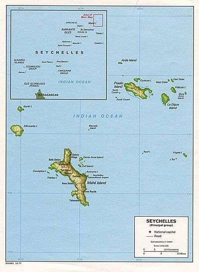
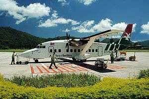
Praslin is home to Praslin Island Airport, while surrounding islands include Curieuse Island, La Digue, Cousin Island, Cousine Island and Aride Island. There are a few near offshore islets including Round Island (.193 km2) and Chauve Souris (.007 km2), both of which have hotel accommodations.
Twice in two weeks in August 2011 bull sharks entered the so-called 'safe bathing' area inside the coral reef of Anse Lazio and attacked and killed swimmers less than 100 ft (30 m) from shore.[2] However, to put this in perspective, these were the first recorded fatal shark attacks in Seychelles for 50 years and none have been recorded after 2011.
A large area in the south of the island has been designated as Praslin National Park and surrounding areas Important Bird Area.
Image gallery
-

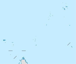
Praslin within Seychelles
-

Map of Praslin
-

Praslin airport
-

Anse Lazio Beach on Praslin
-

Seychelles bulbul (Hypsipetes crassirostris) on Praslin
-

The Vallée de Mai on Praslin Island.
-
Praslin seen from the east
-

View of the second largest island of the Seychelles, Praslin, from Anse Sévère, La Digue, Seychelles
External links
References
- ↑ reserve info
- ↑ "'My handsome and caring husband': Bride's moving tribute to Briton killed by shark as it's revealed tourist died in attack on SAME beach just two weeks ago". Associated Newspapers Ltd. August 17, 2011. Retrieved October 25, 2013.
| Wikimedia Commons has media related to Praslin. |
| Wikivoyage has a travel guide for Praslin. |
