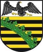
Province of Saxony
| Province of Saxony Provinz Sachsen (German) | ||||||
| Province of Prussia | ||||||
| ||||||
| ||||||
.svg.png) | ||||||
| Capital | Magdeburg 52°8′N 11°37′E / 52.133°N 11.617°ECoordinates: 52°8′N 11°37′E / 52.133°N 11.617°E | |||||
| History | ||||||
| • | Established | 1816 | ||||
| • | Redivided | 1 July 1944 | ||||
| • | Partly reformed | early 1945 | ||||
| • | Disestablished | 1945 | ||||
| Area | ||||||
| • | 1939 | 25,529 km2 (9,857 sq mi) | ||||
| Population | ||||||
| • | 1816 | 1,197,053 | ||||
| • | 1905 | 2,978,679 | ||||
| • | 1939 | 3,662,546 | ||||
| Density | 143.5 /km2 (371.6 /sq mi) | |||||
| Political subdivisions |
| |||||
The Province of Saxony (German: Provinz Sachsen), also known as Prussian Saxony (Preußische Sachsen), was a province of the Kingdom of Prussia and later the Free State of Prussia from 1816 until 1945. Its capital was Magdeburg.
It was formed by the merging of territories, which were formerly the northern part of the Kingdom of Saxony and were ceded to Prussia in 1815, with the duchy of Magdeburg, the Altmark, the Principality of Halberstadt, the formerly-French Principality of Erfurt and other districts, which had been comprised in Prussia from an earlier date.
The province was bounded by Hesse-Nassau, Hanover and Brunswick to the west, Hanover and Brandenburg to the north, Brandenburg and Silesia to the east, and the remnant kingdom of Saxony and small Thuringian states to the south. Its shape was very irregular and entirely surrounded portions of Brunswick and of Thuringian states and itself did possess several exclaves, and its northern portion being almost severed from the southern by the duchy of Anhalt. The majority of population was Protestant, with a Catholic minority (numbering about 8% as of 1905) considered part of the diocese of Paderborn. The province sent 20 members to the Reichstag and 38 delegates to the Prussian House of Representatives (Abgeordnetenhaus).
History
The province was created in 1816 out of the following territories:
- the former Duchy of Magdeburg and Principality of Halberstadt, which had been part of the Kingdom of Westphalia from 1807–1813;
- the parts of the Margraviate of Brandenburg that were situated to the west of the Elbe River, such as the Altmark;
- territory gained from the Kingdom of Saxony after the Battle of Leipzig in 1813: the towns and surrounding territories of Wittenberg, Merseburg, Naumburg, Mansfeld, Querfurt, and Henneberg;
- and territory given to Prussia after the Reichsdeputationshauptschluss: lands around Erfurt (formerly directly subordinate to the Emperor of the French as Principality of Erfurt), the Eichsfeld (formerly belonging to the Archbishopric of Mainz) and the former Imperial Cities of Mühlhausen and Nordhausen.

The Province of Saxony was one of the richest regions of Prussia with highly developed agriculture and industry. In 1932 the province was enlarged with the addition of the regions around Ilfeld and Elbingerode, which had previously been part of the Province of Hanover.
On 1 July 1944, the Province of Saxony was divided along the lines of its three administrative regions. The Erfurt Regierungsbezirk was merged with the Herrschaft Schmalkalden district of the Province of Hesse-Nassau and given to the state of Thuringia. The Magdeburg Regierungsbezirk became the Province of Magdeburg, and the Merseburg Regierungsbezirk became the Province of Halle-Merseburg.
In 1945, the Soviet military administration combined Magdeburg and Halle-Merseburg with the State of Anhalt into the Province of Saxony-Anhalt, with Halle as its capital. The eastern part of the Blankenburg exclave of Brunswick and the Thuringian exclave of Allstedt were also added to Saxony-Anhalt. In 1947, Saxony-Anhalt became a state.
Thuringia and Saxony-Anhalt were abolished in 1952, but were recreated after the reunification of Germany in 1990 with some slight border changes as modern states of Germany. Also territories around Torgau, where was part of Saxony-Anhalt between 1945 and 1952, was passed to Saxony.
Subdivisions
Prior to 1944, the province of Saxony was divided into three Regierungsbezirke. In 1945, only the provinces of Magdeburg and Halle-Merseburg were re-merged.
Regierungsbezirk Magdeburg
.jpg)
Urban districts (Stadtkreise)
- Aschersleben (1901–1950)
- Burg bei Magdeburg (1924–1950)
- Halberstadt (1817–1825 and 1891–1950)
- Magdeburg
- Quedlinburg (1911–1950)
- Stendal (1909–1950)
Rural districts (Landkreise)
- Calbe a./S.
- Gardelegen
- Haldensleben
- Jerichow I
- Jerichow II
- Oschersleben (Bode)
- Osterburg
- Quedlinburg
- Salzwedel
- Stendal
- Wanzleben
- Wernigerode
- Wolmirstedt
Regierungsbezirk Merseburg
Urban districts (Stadtkreise)
- Eisleben (1908–1950)
- Halle a. d. Saale
- Merseburg (1921–1950)
- Naumburg a. d. Saale (1914–1950)
- Weißenfels (1899–1950)
- Wittenberg (Lutherstadt)
- Zeitz (1901–1950)
Rural districts (Landkreise)
- Bitterfeld
- Delitzsch
- Eckartsberga
- Liebenwerda
- Mansfelder Gebirgskreis
- Mansfelder Seekreis
- Merseburg
- Querfurt
- Saalkreis
- Sangerhausen
- Schweinitz
- Torgau
- Weißenfels
- Wittenberg
- Zeitz
Regierungsbezirk Erfurt
Urban districts (Stadtkreise)
- Erfurt (1816–18 and 1872–present)
- Mühlhausen (1892–1950)
- Nordhausen (1882–1950)
Rural districts (Landkreise)
- Hohenstein county
- Heiligenstadt
- Langensalza
- Mühlhausen
- Schleusingen
- Weißensee
- Worbis
- Ziegenrück
See also
- People from the Province of Saxony
References
- Handbuch der Provinz Sachsen, Magdeburg, 1900.
- Jacobs, Geschichte der in der preussischen Provinz Sachsen vereinigten Gebiete, Gotha, 1884.
- Die Provinz Sachsen in Wort und Bild, Berlin, 1900 (reprint: Naumburger Verlagsanstalt 1990, ISBN 3-86156-007-0).
External links
| Wikisource has the text of the 1911 Encyclopædia Britannica article Saxony (province). |
- Further information (German)
- Administrative subdivision and population breakdown of Saxony province, 1900/1910 (German)

