Pueblo Viejo Canton
| Pueblo Viejo Canton | |
|---|---|
| Canton | |
 Location of Los Rios Province in Ecuador. | |
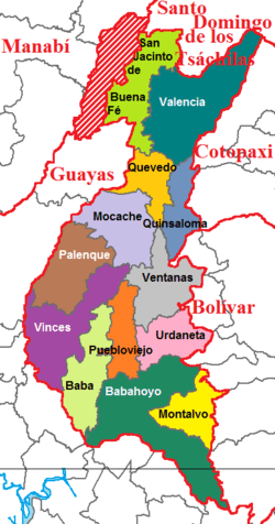 Cantons of Los Ríos Province | |
| Country |
|
| Province | Los Ríos Province |
| Capital | Pueblo Viejo |
| Area | |
| • Total | 129.8 sq mi (336.3 km2) |
| Population (2001) | |
| • Total | 29,420 |
| Time zone | ECT (UTC-5) |
Pueblo Viejo Canton is a canton of Ecuador, located in the Los Ríos Province. Its capital is the town of Pueblo Viejo. Its population at the 2001 census was 29,420.[1]
Demographics
Ethnic groups as of the Ecuadorian census of 2010:[2]
- Montubio 51.9%
- Mestizo 37.8%
- Afro-Ecuadorian 5.6%
- White 2.7%
- Indigenous 1.9%
- Other 0.2%
Geography and climate
It is located in the center of the province of Los Ríos. It covers an area of 336.3 square kilometres.
The Rio Puebloviejo flows through the village, with a series of tributaries that feed it and a lot of estuaries and streams. The weather is warm and humid with temperatures varying between 27 and 28 degrees Celsius.
History
Puebloviejo is mentioned in early chronicles in 1616, mentioning the fork in the river. In 1693, in the period of King Juan Carlos II of Spain, Puebloviejo was part of the Territory of Guayaquil.
In 1808, Puebloviejo became one of the 14 districts of the Province of Guayaquil. On October 9, 1820, Guayaquil proclaimed their independence from Spanish rule, causing Puebloviejo to proclaim its independence on 12 October, recognized as independence day in the canton.
During the presidency of Vicente Ramón Roca, by legislative decree on February 7 of 1846, it became a canton. During the months of February and March 2008, San Francisco de Puebloviejo suffered from severe flooding in Ecuador, whichaffected not only crops but also houses and a large number of families in the area.[3]
Economy
Many of the inhabitants are employed in agriculture. Besides being the largest producer of bananas within the Province, the canton has produced cocoa since colonial times. It also produces tagua, fine woods, tropical fruits, coffee, rice, corn, soybean, passion fruit, tomato and others.
References
- ↑ Cantons of Ecuador at statoids.com
- ↑
- ↑ COOPI - NGO Cooperazione Internazionale (2008). "Report situation - Province Los Rios" (PDF).
Coordinates: 1°33′00″S 79°32′02″W / 1.55000°S 79.53389°W