Rabí
| Rabí | |||
|---|---|---|---|
| Municipality | |||
|
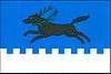
Landscape around Rabí village with Rábí castle in the background. | |||
| |||
 Rabí | |||
| Coordinates: 49°17′2″N 13°37′28″E / 49.28389°N 13.62444°ECoordinates: 49°17′2″N 13°37′28″E / 49.28389°N 13.62444°E | |||
| Country |
| ||
| Region | Plzeň | ||
| District | Klatovy | ||
| Area | |||
| • Total | 14.29 km2 (5.52 sq mi) | ||
| Elevation | 478 m (1,568 ft) | ||
| Population (1.1.2015) | |||
| • Total | 507 | ||
| • Density | 35/km2 (92/sq mi) | ||
| Postal code | 342 01 | ||
| Website | http://obecrabi.wz.cz/ | ||
.JPG)
Rabí is a village and municipality (obec) in Klatovy District in the Plzeň Region of the Czech Republic.
The municipality covers an area of 14.29 square kilometres (5.52 sq mi), and has a population of 468 (as at 2 October 2006).
Rabí lies approximately 28 kilometres (17 mi) south-east of Klatovy, 55 km (34 mi) south of Plzeň, and 106 km (66 mi) south-west of Prague.
History
Until 1918, the village was part of the Austrian monarchy (Austria side after the compromise of 1867), in the Strakonitz (Strakonice) district, one of the 94 Bezirkshauptmannschaften in Bohemia. A post-office was opened in 1869.[1]
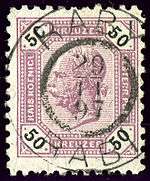
Austrian KK stamp, bilingual cancelled in 1897
References
- ↑ Die postalischen Abstempelungen auf den österreichischen Postwertzeichen-Ausgaben 1867, 1883 und 1890, Wilhelm KLEIN, 1967
| Wikimedia Commons has media related to Rabí. |
This article is issued from Wikipedia - version of the 4/7/2016. The text is available under the Creative Commons Attribution/Share Alike but additional terms may apply for the media files.