Ravensdale, Washington
| Ravensdale, Washington | |
|---|---|
| CDP | |
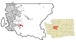 Location of Ravensdale, Washington | |
| Coordinates: 47°21′24″N 121°58′39″W / 47.35667°N 121.97750°WCoordinates: 47°21′24″N 121°58′39″W / 47.35667°N 121.97750°W | |
| Country | United States |
| State | Washington |
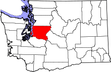
| County | King |
| Area | |
| • Total | 5.1 sq mi (13.3 km2) |
| • Land | 5.0 sq mi (13.0 km2) |
| • Water | 0.1 sq mi (0.3 km2) |
| Elevation | 623 ft (190 m) |
| Population (2010) | |
| • Total | 1,101 |
| • Density | 162.3/sq mi (62.7/km2) |
| Time zone | Pacific (PST) (UTC-8) |
| • Summer (DST) | PDT (UTC-7) |
| ZIP code | 98051 |
| Area code(s) | 425 |
| FIPS code | 53-57395[1] |
| GNIS feature ID | 1524908[2] |
Ravensdale is a census-designated place (CDP) in King County, Washington, United States. The population was 1,101 at the 2010 census. It is in the Pacific Standard Time Zone. The elevation is 623 feet (190 m).
Based on per capita income, one of the more reliable measures of affluence, Ravensdale ranks 50th of 522 areas in the state of Washington to be ranked.
History

Ravensdale was originally called Leary, after the name of Leary Coal Company, in turn named for John Leary, a Seattle coal speculator. The later name came from the flocks of ravens that fed on grain spilled from the boxcars on the Northern Pacific Railroad tracks that ran through the town. Underground coal mining commenced around 1899 by the Seattle and San Francisco Railway and Navigation Company, although coal had been mined in nearby Danville and Landsburg a few years earlier. The coal mines were later acquired by Northwest Improvement Company (NWI), a subsidiary of Northern Pacific. In 1907, Ravensdale, Washington was a coal mining town with a population of about 1,000 residents, most of whom worked for the mining company. Ravensdale was officially incorporated on August 15, 1913. On November 16, 1915 at 1:25 p.m. an explosion occurred at the mine killing thirty-one men, one of the worst coal mining accidents in Washington state history. The NWI mine was closed permanently and many of the immigrant miners left town seeking work elsewhere. A number of coal miners from Ravensdale moved to Ray, Arizona to mine copper.
Over the decades coal mining continued to fuel Ravensdale's economy as new mines were developed operating on the Danville, Landsburg, and McKay coal seams. The Dale Coal Company became one of the more successful from about 1924-1941, followed by the Continental Coal Company from 1942–1944, the Anderson Coal Company from 1943–1948; and Palmer Coking Coal Company from 1937-1975. On January 29, 1955 four miners were lost in the Landsburg mine when a cave-in filled the mine with water, mud and debris. On December 17, 1975 at 2:30 p.m., the Rogers No. 3 mine was dynamited shut by Palmer Coking Coal Company. This was the last underground coal mine in the state of Washington.
References: Washington Geologic Survey Bulletin No. 3 by George Watkin Evans (1912); Washington State Coal Mine Inspector Reports (1887–1975); Ravensdale Reflections by Barbara Nilson (copyright 2004; Washington State Place Names by James Phillips (1972); Voice of the Valley newspaper (December 16, 2008 page 8); State of Washington Fatal Accident Report for 1955 by C.R. Holmes
Geography
Ravensdale is located at 47°21′24″N 121°58′39″W / 47.35667°N 121.97750°W (47.356665, -121.977612).[3]
According to the United States Census Bureau, the CDP has a total area of 5.1 square miles (13.3 km²), of which, 5.0 square miles (13.0 km²) of it is land and 0.1 square miles (0.3 km²) of it (2.14%) is water.
Climate
This region experiences warm (but not hot) and dry summers, with no average monthly temperatures above 71.6 °F. According to the Köppen Climate Classification system, Ravensdale has a warm-summer Mediterranean climate, abbreviated "Csb" on climate maps.[4]
Demographics
As of the census[1] of 2000, there were 816 people, 301 households, and 217 families residing in the CDP. The population density was 162.3 people per square mile (62.6/km²). There were 321 housing units at an average density of 63.8/sq mi (24.6/km²). The racial makeup of the CDP was 96.08% White, 0.12% African American, 1.23% Native American, 0.12% Asian, 0.25% Pacific Islander, 0.12% from other races, and 2.08% from two or more races. Hispanic or Latino of any race were 1.23% of the population.
There were 301 households out of which 36.9% had children under the age of 18 living with them, 62.8% were married couples living together, 6.0% had a female householder with no husband present, and 27.9% were non-families. 22.3% of all households were made up of individuals and 5.6% had someone living alone who was 65 years of age or older. The average household size was 2.71 and the average family size was 3.19.
In the CDP the population was spread out with 26.1% under the age of 18, 7.6% from 18 to 24, 27.1% from 25 to 44, 29.9% from 45 to 64, and 9.3% who were 65 years of age or older. The median age was 41 years. For every 100 females there were 108.2 males. For every 100 females age 18 and over, there were 110.8 males.
The median income for a household in the CDP was $44,850, and the median income for a family was $61,741. Males had a median income of $33,182 versus $30,536 for females. The per capita income for the CDP was $28,300. About 6.1% of families and 10.8% of the population were below the poverty line, including 12.7% of those under age 18 and 7.8% of those age 65 or over.
10% of Ravensdale residents aged 25 and older have a bachelor's degree.
Commute
The average commute time for Ravensdale workers is 31 minutes, compared with 26 minutes nationwide.
Public schools
Tahoma Junior High School is a public school residing in the Tahoma School District and accommodates grades 8-9. Current enrollment is 1090 students
Notable people
Brandi Carlile, singer-songwriter
Notable organizations
Lake Retreat Camp, a camp and Christian conference center located on Lake Retreat
References
- 1 2 "American FactFinder". United States Census Bureau. Retrieved 2008-01-31.
- ↑ "Ravensdale". Geographic Names Information System. United States Geological Survey.
- ↑ "US Gazetteer files: 2010, 2000, and 1990". United States Census Bureau. 2011-02-12. Retrieved 2011-04-23.
- ↑ Climate Summary for Ravensdale, Washington
| Wikimedia Commons has media related to Ravensdale, Washington. |
Municipalities and communities of King County, Washington, United States | ||
|---|---|---|
| Cities |
|  |
| Towns | ||
| CDPs |
| |
| Unincorporated communities | ||
| Indian reservation | ||
| Ghost towns | ||
| Footnotes | ‡This populated place also has portions in an adjacent county or counties | |