Rdeči Breg, Lovrenc na Pohorju
| Rdeči Breg | |
|---|---|
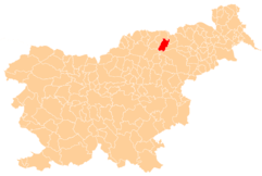
 Rdeči Breg Location in Slovenia | |
| Coordinates: 46°33′6.85″N 15°22′35.95″E / 46.5519028°N 15.3766528°ECoordinates: 46°33′6.85″N 15°22′35.95″E / 46.5519028°N 15.3766528°E | |
| Country |
|
| Traditional region | Styria |
| Statistical region | Drava |
| Municipality | Lovrenc na Pohorju |
| Area | |
| • Total | 11.49 km2 (4.44 sq mi) |
| Elevation | 555 m (1,821 ft) |
| Population (2002) | |
| • Total | 248 |
| [1] | |
Rdeči Breg (pronounced [əɾˈdeːtʃi ˈbɾeːk]) is a dispersed settlement in the Municipality of Lovrenc na Pohorju in northeastern Slovenia. It extends from the right bank of the Drava River in the Pohorje Hills and part of the settlement lies in the adjacent Municipality of Podvelka. The area was part of the traditional region of Styria. It is now included in the Drava Statistical Region.[2]
References
External links
| Settlements | Administrative centre: Lovrenc na Pohorju
|  |
|---|---|---|
| Landmarks |
| |
This article is issued from Wikipedia - version of the 4/17/2016. The text is available under the Creative Commons Attribution/Share Alike but additional terms may apply for the media files.