Red Gap, British Columbia
| Red Gap | |
|---|---|
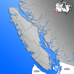 Location of Red Gap within the Nanaimo District on Vancouver Island | |
| Coordinates: 49°15′11″N 124°10′16″W / 49.25306°N 124.17111°WCoordinates: 49°15′11″N 124°10′16″W / 49.25306°N 124.17111°W | |
| Country |
|
| Province |
|
| Region | Vancouver Island |
| Regional district | Nanaimo Regional District |
| Elevation | 0 m (0 ft) |
| Population (2009) | |
| • Total | 0 |
| • Density | 0/km2 (0/sq mi) |
| Time zone | PST (UTC-8) |
Red Gap is a ghost town in the vicinity of Nanoose Bay, British Columbia, which was the site of a lumber mill. The community's name was inspired by Harry Leon Wilson's novel Ruggles of Red Gap.[1]
Location
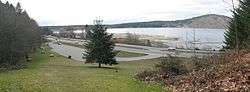
Red Gap was the location of a lumber mill on the shore of Nanoose Bay across the water from the present location of CFMETR. The settlement of Red Gap was across the road and E&N Railway line from the mill.
History
In 1912 Joe and Max McKercher established a modern lumber mill at Red Gap. The mill was taken over by Newcastle Lumber Company and Merchant Trust and then, in 1917 by Frank Pendleton as the Straits Lumber Company. Ships from around the world took on lumber that was barged across the bay from the mill. Japan was a primary customer of the lumber products produced. Lumber was milled to unique Japanese dimensions. The mill and accommodations for workers were built on pilings because there was insufficient land between the railway and the shoreline for the mill. Across the road and railway line a company store, a post office, a school, homes and boarding houses were built. There were separate areas where workers from Japan, India and China lived. The mill remained busy through the 1930s however when Japan attacked Pearl Harbor in 1941, the mill lost its best customer and within months Straits Lumber was out of business. A fire during demolition in 1942 destroyed the mill which had damage from another fire two years earlier as well. The site continued in use by smaller operations into the early 1950s. For 3 years, at the peak of its operations, the Straits mill was the biggest mill in the Pacific Northwest.[1]
Modern day
Today the site is marked by a rest area on the south bound side of Highway 19. No houses or other buildings remain. The name Red Gap is used by a shopping centre and some businesses in nearby Nanoose Bay. The pilings upon which the mill stood remain in 2015.
References
External links
- August 2008 Newsletter Published by Parksville & District Historical Society with photo of mill. Accessed March 17, 2009