Rheinburgenweg Trail
| Rheinburgenweg | |
|---|---|
| Length | 195 km (121 mi) |
| Location | Rhineland-Palatinate/Hesse, Germany |
| Trailheads | Bingen, Koblenz |
| Use | Hiking |
| Elevation | |
| Elevation change | 3,900 m (12,800 ft) |
| Highest point | 462 m (1,516 ft) |
| Lowest point | 59 m (194 ft) |
| Hiking details | |
| Trail difficulty | Easy |
| Season | All year |
| Sights | Numerous castles along the Rhine Gorge. |
| Hazards | Mountain bikers |
Rhine Castle trail - Rheinburgenweg (previously: Rheinburgen-Wanderweg), follows the left side of the Rhine from Bingen to Remagen-Rolandseck and the right side takes the route of the Rheinsteig from Rüdesheim am Rhein to Koblenz.

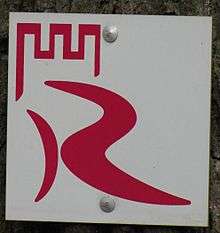
trail marker
Route and sights of interest
- Rüdesheim am Rhein
- Boosenburg
- Brömserburg
- Ruine Ehrenfels
- Assmannshausen
- Lorch
- Ruine Nollig
- Pfalzgrafenstein
- Burg Gutenfels
- Loreley
- Burg Katz
- Burg Maus
- Marksburg
- Lahneck Castle
- Festung Ehrenbreitstein
- Koblenz
- Kurfürstliche Residenz
- Stolzenfels Castle
- Königsstuhl von Rhens
- Klostergut Jokobsberg
- Burg Boppard
- Burg Rheinfels
- Schönburg (Rhein)
- Stahleck Castle
- Burg Fürstenberg
- Heimburg in Niederheimbach
- Burg Sooneck
- Burg Reichestein
- Burg Rheinstein
- Mouse Tower
- Klopp Castle
- Bingen am Rhein
External links
| Wikimedia Commons has media related to Rheinburgenweg. |
| Wikivoyage has a travel guide for Rheinburgenweg. |
This article is issued from Wikipedia - version of the 4/7/2016. The text is available under the Creative Commons Attribution/Share Alike but additional terms may apply for the media files.