Riacho Fundo
| Riacho Fundo | ||
|---|---|---|
| Administrative region | ||
| Região Administrativa do Riacho Fundo Administrative Region of Riacho Fundo | ||
| ||
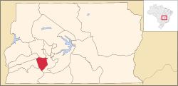 Location of Riacho Fundo in the Federal District | ||
 Riacho Fundo Location of Riacho Fundo in Brazil | ||
| Coordinates: 15°55′S 48°01′W / 15.91°S 48.02°WCoordinates: 15°55′S 48°01′W / 15.91°S 48.02°W | ||
| Country | Brazil | |
| Region | Central-West | |
| State | Federal District | |
| Founded | January 13, 1993 | |
| Government | ||
| • Regional administrator | Arthur da Cunha Nogueira | |
| Area | ||
| • Total | 56.02 km2 (21.63 sq mi) | |
| Population (2013)[1] | ||
| • Total | 37,278 | |
| • Density | 670/km2 (1,700/sq mi) | |
| Time zone | BRT (UTC-3) | |
| • Summer (DST) | BRST (UTC-2) | |
| Postal Code (CEP) | 71800-000 | |
| Area code(s) | +55 61 | |
| Website |
www | |

Riacho Fundo is an administrative region in the Federal District, Brazil.
See also
References
- ↑ "Pesquisa Distrital por Amostra de Domicílios - 2010/2011" (PDF) (in Portuguese). Codeplan. Retrieved 2013-04-09.
External links
-
 Media related to Riacho Fundo at Wikimedia Commons
 - Page of the Regional Administration of Riacho Fundo
- Page of the Government of the Federal District
Seat of government: Brasília | |||||||
|
This article is issued from Wikipedia - version of the 12/1/2016. The text is available under the Creative Commons Attribution/Share Alike but additional terms may apply for the media files.