Ribes de Freser
| Ribes de Freser | ||
|---|---|---|
| Municipality | ||
|
| ||
| ||
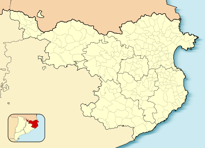
 Ribes de Freser  Ribes de Freser Location in Catalonia | ||
| Coordinates: 42°18′34″N 2°10′17″E / 42.30944°N 2.17139°ECoordinates: 42°18′34″N 2°10′17″E / 42.30944°N 2.17139°E | ||
| Country |
| |
| Community |
| |
| Province | Girona | |
| Comarca | Ripollès | |
| Government | ||
| • Mayor | Marc Prat Arrey (2015)[1] | |
| Area[2] | ||
| • Total | 41.9 km2 (16.2 sq mi) | |
| Elevation | 912 m (2,992 ft) | |
| Population (2014)[1] | ||
| • Total | 1,859 | |
| • Density | 44/km2 (110/sq mi) | |
| Demonym(s) | Ribetà, ribetana | |
| Website |
www | |
Church of Santa Maria and Town Hall
Ribes de Freser (Catalan pronunciation: [ˈriβəz ðə fɾəˈze]) is a municipality in the comarca of the Ripollès in Girona, Catalonia, Spain. It is situated at the confluence of the Freser, Rigard and Segadell rivers, 14 km (8.7 mi) north of Ripoll. It is known for its mineral water, paper manufacture and milk products, and is also an important tourist centre. A rack railway runs from the town to Queralbs and to the shrine of Núria, through the Vall de Núria. The town is on the communication route from Barcelona to Puigcerdà (N-152 road and RENFE railway line).
Demography
| 1900 | 1930 | 1950 | 1970 | 1986 | 2005 |
|---|---|---|---|---|---|
| 1699 | 2965 | 3564 | 3133 | 2627 | 2044 |
See also
References
- 1 2 "Ajuntament de Ribes de Freser". Generalitat of Catalonia. Retrieved 2015-11-13.
- ↑ "El municipi en xifres: Ribes de Freser". Statistical Institute of Catalonia. Retrieved 2015-11-23.
- Panareda Clopés, Josep Maria; Rios Calvet, Jaume; Rabella Vives, Josep Maria (1989). Guia de Catalunya, Barcelona:Caixa de Catalunya. ISBN 84-87135-01-3 (Spanish). ISBN 84-87135-02-1 (Catalan).
External links
 |
Planoles | Queralbs |  | |
| Campelles | |
Pardines | ||
| ||||
| | ||||
| Campdevànol | Ogassa |
This article is issued from Wikipedia - version of the 11/10/2016. The text is available under the Creative Commons Attribution/Share Alike but additional terms may apply for the media files.
