River Sprint
Coordinates: 54°24′32.2″N 2°45′45.9″W / 54.408944°N 2.762750°W
| Sprint | |
| River | |
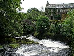 The Sprint at Garnett Bridge | |
| Country | England |
|---|---|
| Source | |
| - location | Harter Fell |
| Mouth | |
| - location | confluence with River Kent |
The River Sprint is a river in Cumbria, England with its source high up on the south-facing side of Harter Fell. It flows into the River Kent just to the south of Burneside.
The first two miles of the river is made up of a series of short flat sections interspersed by spectacular water falls, before it enters Longsleddale valley. When in Longsleddale, it begins to get wider as it is fed by a large number of streams (known as becks; a term derived from Old Norse).
The River Sprint is the fastest rising river in England, and frequently floods in Longsleddale valley, making the road impassable. The river is spectacular at times of high flow, and is popular with canoeists and fishermen. The Environment Agency’s Catchment Restoration Fund has funded a project to improve the Sprint's water quality and alleviate flooding as part of a wider initiative called the "Source to Sea Programme". This involves restoration of peatlands in the catchment areas of rivers feeding into Morecambe Bay.[1]