Rohat Tuek
| Rohat Tuek ឃុំរហាត់ទឹក | |
|---|---|
| Commune and village | |
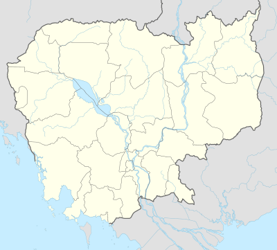
 Rohat Tuek Location within Cambodia | |
| Coordinates: 13°29′N 102°59′E / 13.483°N 102.983°ECoordinates: 13°29′N 102°59′E / 13.483°N 102.983°E | |
| Country |
|
| Province | Banteay Meanchey |
| District | Mongkol Borei District |
| Villages | 13 |
| Time zone | UTC+07 |
| Geocode | 010208 |
Rohat Tuek is a khum (commune) and village of Mongkol Borei District in Banteay Meanchey Province in western Cambodia.[1]
Villages
- Pou Pir Daeum (ពោធិ៍ពីរដើម)
- Rohat Tuek (រហាត់ទឹក)
- Thnal Bat (ថ្នល់បត់)
- Kramol
- Khtum Chrum
- Chak Lech
- Doun Mul
- Preaek Samraong (ព្រែកសំរោង)
- Ou Dangkao (អូរដង្កោ)
- Chamkar Chek (ចំការចេក)
- Ou Chuob
- Ka Svay
- Chak Kaeut
References
- ↑ "Banteay Meanchey". cambodia.gov.kh.
This article is issued from Wikipedia - version of the 11/2/2015. The text is available under the Creative Commons Attribution/Share Alike but additional terms may apply for the media files.
