Rudnica, Podčetrtek
| Rudnica | |
|---|---|
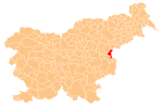
 Rudnica Location in Slovenia | |
| Coordinates: 46°8′54.08″N 15°32′14.04″E / 46.1483556°N 15.5372333°ECoordinates: 46°8′54.08″N 15°32′14.04″E / 46.1483556°N 15.5372333°E | |
| Country |
|
| Traditional region | Styria |
| Statistical region | Savinja |
| Municipality | Podčetrtek |
| Area | |
| • Total | 0.93 km2 (0.36 sq mi) |
| Elevation | 548.1 m (1,798.2 ft) |
| Population (2002) | |
| • Total | 32 |
| [1] | |
Rudnica (pronounced [ˈɾuːdnitsa]) is a small settlement on the southern slopes of a hill with the same name, to the west of Olimje in the Municipality of Podčetrtek in eastern Slovenia. The area around Podčetrtek was traditionally part of the region of Styria. It is now included in the Savinja Statistical Region.[2]
References
External links
| Settlements | Administrative centre: Podčetrtek
|  | ||||||
|---|---|---|---|---|---|---|---|---|
| Landmarks |
| |||||||
This article is issued from Wikipedia - version of the 6/21/2016. The text is available under the Creative Commons Attribution/Share Alike but additional terms may apply for the media files.