Soli, Cyprus
| Σόλοι | |
|
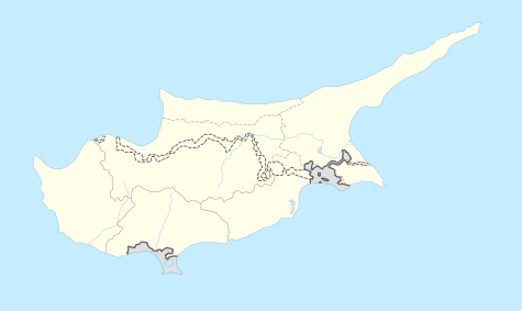
Map showing the 10 ancient city Kingdoms of Cyprus | |
 Shown within Cyprus | |
| Location | Cyprus |
|---|---|
| Region | Nicosia District |
| Coordinates | Coordinates: 35°08′25″N 32°48′45″E / 35.1404°N 32.8126°E |

Soli or Soloi (Greek: Σόλοι) is an ancient Greek city in the island of Cyprus, located southwest of Morphou and on the coast in the gulf of Morphou and dates back to about the 6th century BC. Since 1974 the city has lain in the de facto Turkish Republic of Northern Cyprus.
Originally, Soloi was located in a much constricted geographical location. At its current location, the whole urban centre was designed by Solon during his 10-year trip, after whom the name Soloi is commonly attributed. Reyes, however, disputes this etymological origin, as the name Soloi appears on the Esarhaddon prism predating Solon's visit.[1] Soloi was one of the ten city-kingdoms into which Cyprus was divided at the time.
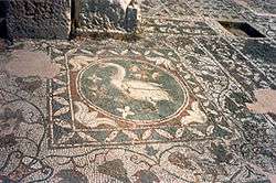
What remains today is mainly from the Roman period, most notably the mosaic floor of the basilica with its wealth of birds, animals and geometric designs and a picture of a swan. There is a theatre but it has been restored so much that it no longer has any atmosphere of its original age.
Famous people from Soli
- Nicocles, son of Pasicrates, who accompanied Alexander to India (Arrian, Indica 18.8).
- Stasanor, 4th century BC general of Alexander the Great and later governor of Drangiana, Bactria and Sogdiana, following the partition of Triparadisus (Arrian, Successors 35).
- Hiero of Soli, who was sent by Alexander to circumnavigate the Arabian peninsula, and went as far as the mouth of the Persian Gulf.
- Clearchus of Soli, 4th century BC peripatetician philosopher, thought to have been to Alexandria on the Oxus, in Bactria.
The city of Soli in Cilicia and solecism
There is also another city by the same name, Soli, Cilicia. The Athenians considered their dialect as uncultured and used the word σόλοικος to refer to incorrect speech, hence the English word solecism.[2]
See also
References
Coordinates: 35°08′25″N 32°48′45″E / 35.1404°N 32.8126°E