Rushikulya
| Rushikulya | |
| River | |
 The Rushikulya River | |
| Name origin: From Sanskrit | |
| Country | India |
|---|---|
| Parts | Odisha |
| Administrative areas |
Kandhamal, Ganjam |
| Tributaries | |
| - left | Baghua, Dhanei, Badanadi |
| - right | Ghodahada |
| Source | |
| - location | Daringbadi, Kandhamal, Odisha, India |
| - coordinates | 19°04′N 84°01′E / 19.07°N 84.01°E |
| Mouth | Puruna Bandha |
| - location | Chhatrapur, Ganjam, Odisha, India |
| - elevation | 0 m (0 ft) |
| Length | 165 km (103 mi) |
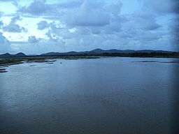
The Rushikulya River is one of the major/important rivers of Odisha state and covers entire catchment area in the districts of Kandhamal and Ganjam district of Odisha. The Rushikulya originates at an elevation of about 1000 metres from Daringbadi hills. The place from where the river originates, Daringbadi is called the ' Kashmir of Odisha '. The river lies within the geographical coordinates of 19.07 to 20.19 north latitude and 84.01 to 85.06 east longitude. It meets the Bay of Bengal at Puruna Bandha of Chhatrapur block. Its tributaries are the Baghua, the Dhanei, the Badanadi etc. It has no delta as such at its mouth.
Area under Rushikulya
The river flows from the Daringbadi hill station of Kandhamal district and in Ganjam district it flows through Surada, Dharakote, Asika, Pitala, Purusottampur, Taratarini,Pratappur, Alladigam, Brahmapur, Ganjam and finally at Chhatrapur block. It is 165 km long with the total catchment area is 7700 km2.
Survey for Olive Ridley turtles
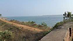
In 1993, biologists from the Odisha Forest Department and the Wildlife Institute of India learned that large scale nesting of Olive Ridley turtles was taking place near the mouth of the Rushikulya river. This area is the location of one of the largest mass nesting (arribada) sites of olive ridley sea turtles in India.[1] The villages near the mouth are Pali Bandha, Puruna Bandha, Gokhara Kuda and Kantia Pada, where one can find the nesting sites of the olive ridley turtles. These villages basically are fishermen's villages.
Urban Centres
Only one city Berhampur is situated in the basin and important towns are Chhatrapur, Ganjam, Aska, Bhanjanagar and Surada.
Industries
A number of large scale industries have been set up in the basin. Among them are M/s Jayashree Chemical Industries. Aska Co-operative Sugar Industries Ltd.Nuagam, Aska Spinning Mills, Monorama Chemical Works Ltd., Orissa Tubes Pvt. Ltd., etc. There are about 3360 numbers of small scale industries of different categories mainly food and allied, forest & wood based, rubber and plastic products and glass and ceramics. There is enough scope for setting up forest based industries. The basin is rich in mineral wealth. The major economic minerals are clay, lime stone, manganese, sand talc, black sand and grinding materials.
References
- ↑ http://world-turtle-trust.org World Turtle Trust
External links
Coordinates: 19°55′N 84°08′E / 19.917°N 84.133°E