São Roque (Funchal)
| São Roque | |
| Civil Parish | |
| Official name: Freguesia de São Roque | |
| Name origin: Portugues for Saint Roch | |
| Country | |
|---|---|
| Region | |
| Island | Madeira |
| Municipality | Funchal |
| Center | São Roque |
| - elevation | 378 m (1,240 ft) |
| - coordinates | 32°40′24″N 16°55′30″W / 32.67333°N 16.92500°WCoordinates: 32°40′24″N 16°55′30″W / 32.67333°N 16.92500°W |
| Highest point | |
| - elevation | 1,600 m (5,249 ft) |
| Lowest point | |
| - elevation | 140 m (459 ft) |
| Area | 7.50 km2 (3 sq mi) |
| Population | 9,385 (2011) |
| Density | 1,251/km2 (3,240/sq mi) |
| Settlement | fl. 1579 |
| - Parish | 3 March 1579 |
| LAU | Junta Freguesia |
| - location | Estrada de Comandante Camacho de Freitas |
| President Junta | Rui Emanuel de Freitas Nunes (PPD-PSD) |
| President Assembleia | Susana Maria Florença Pinto Correia (PPD-PSD) |
| Timezone | WET (UTC0) |
| - summer (DST) | WEST (UTC+1) |
| Postal Zone | 9020-155 |
| Area Code & Prefix | (+351) 291 XXX XXX |
| Patron Saint | São Roque |
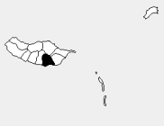 Location of the parish seat of São Roque in the municipality of Funchal, island of Madeira | |
| Wikimedia Commons: São Roque (Funchal) | |
São Roque is a civil parish in the northern part of the municipality of Funchal in the archipelago of Madeira. The population in 2011 was 9,385,[1] in an area of 7.50 km².[2]
History
The lands associated with São Roque were once part of a much larger parish of Sé, but later, for a short period it was part of São Pedro. The eccliastical parish of São Roque was dismembered from São Pedro and neighbouring São Martinho by Cardinal Infante Henrique on 3rd March 1579. The Cardinal authorised the prelate of Funchal to create a new parish within the dominion of Sé. This was instituted with its parish seat at the ancient chapel of São Roque, constructed by the residents at the beginning of the 16th century, probably from local funds collected by Funchal's citizens (Saint Roch was the patron saint of Funchal protecting them from the plague, during the early part of the 16th century).
The small chapel provided its name to a church later erected in 1704, not far from the original building (which remains standing, and is referred to locally as the Igreja Velha, or small church, in Portuguese). But, during the construction there were budgetary deficits, resulting in a slow building process, that eventually resulted in the building's ruin by 1790. A newer church, chiefed (?) by engineer António Vila Vicêncio, was later erected; its main construction continued until 1820, but was finally completed in the middle of the 19th century.
Geography
São Roque is connected by regional roadway with Monte, Funchal and Faial, and towards São Martinho and northwest to Curral das Freiras. São Roque is not connected with the urban sprawl of Funchal, but developed from the concentration of agricultural use lands, developing into a suburban nucleus later. This includes several of its localities, which were formed from rural concentrations, and developed into residential booroughs by the 20th century: Achada, Muro da Coelha, Conceição, Fundoa, Igreja Velha, Calhau, Igreja Nova, Alegria, Bugiaria, Lombo Segundo, Lombo de São João and Santana.
Economy
Until the mid-20th century, the region was primarily agricultural, but the southern limits of the parish have now been developed extensively towards the foothills of the central mountain range.