Söderslätt

Söderslätt is a Swedish agricultural district with very high quality soil. It is located in the south-west of Scania, at the southernmost peak of the Scandinavian peninsula. It isn't an administrative area but is usually considered to comprise four municipalities: Skurup, Svedala, Trelleborg and Vellinge (of which the latter includes the Falsterbo peninsula).[1][2]
A fairly mild winter climate in combination with stone-free boulder clay gives the area very good yield [3] It is located east of Malmö, south-east of Lund and down to the southernmost peak of Sweden Smygehuk (latitude N 55°20′).[1]
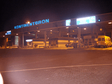
Trelleborg with its important car and lorry ferry port is the main town of the area.
- TT-Line sails from Trelleborg to Travemünde and Rostock in Germany and to Swinoujscie in Poland[4]
- Unity Line also sails from Trelleborg to Swinoujscie [5]
- Stena Line (previously Scandlines) sails from Trelleborg to Saßnitz and Rostock, both in Germany.[6][7]
Most of the ferry transports are lorries, and this makes Trelleborg's port the largest in Sweden in terms of goods by weight. In 2005, 11 million metric ton of goods passed through the port (along with almost 2 million passengers).[8]
Malmö airport Sturup (ICAO: ESMS, IATA: MMX) is located some 35 km east of that city and is located at Söderslätt.[9] It's an airport of rather low importance. Domestic flights to Stockholm departure around every hour. To this only a few daily international departures can be added.[9] The main reason for Sweden's third-largest city to have such a small airport is that Kastrup Airport (ICAO:EKCH, IATA: CPH) in Copenhagen, Denmark is located closer (to Malmö), have train connections and Kastrup has worldwide connections, it is the largest airport in Scandinavia.[10]
Söderslätt has only a few tiny beech forests, and on sandy soil the typical combination of pine and birch instead. The landscape almost lacks lakes and rivers. A few ponds and minor streams. The Falsterbo peninsula is connected to Söderslätt, though physically separated by the canal known as Falsterbokanalen.[11] Falsterbo Horse Show is organized annually in Falsterbo,[12] where also several links golf courses are located.[13] They are typically opened all year, but may close (or use special "winter greens") in case of snow. Falsterbo is most well known as an important ornithological station.[14][15]
Migratory birds are flying toward the south-west during the autumn, many of them attempt to follow land as long as they can (especially such birds that cannot land on water), and as Falsterbo is located as south-west as possible at the Scandinavian peninsula. The migratory birds tend to gather around Falsterbo for a rest or until the weather conditions are good in order to fly across the Baltic Sea to the European Continent. The high number of migratory birds during September, October and November also attract birds of prey to the area.
References
- 1 2 "Välkommen!". skane.org. Retrieved 6 August 2015.
- ↑ Climate please see Scania, headline "Climate" and table of monthly/annual meteorological stations "Falsterbo" and "Smygehuk" – these can be compared to meteorological stations further north in Sweden, in the same climate table. (That climate table is sourced)
- ↑ http://www.lansstyrelsen.se/skane/sv/samhallsplanering-och-kulturmiljo/landskapsvard/kulturmiljoprogram/oversiktliga-kommunbeskrivningar/Pages/Skurup.aspx. Swedish "Jordartsinnehållet på Söderslätt domineras av den så kallad 'sydvästmoränen', en kalkrik, relativt stenfattig moränlera, som erbjuder gynnsamma förutsättningar för växtodling." Means "The earth deposit at Söderslätt is dominated by the so-called 'southwest boulder', a soil rich of chalk, few-stones-boulder-clay, offering good conditions to vegetational growth"
- ↑ "Ferries between Germany, Poland and Sweden - TT-Line". ttline.com. Retrieved 6 August 2015.
- ↑ "Gods- och passagerarfärjor". unityline.se. Retrieved 6 August 2015.
- ↑ "Färja till Tyskland - Åk bekvämt - Stena Line". stenaline.se. Retrieved 6 August 2015.
- ↑ "Stena Line". ferries.se. Retrieved 6 August 2015.
- ↑ Nils-Åke Siversson & John Bitton "Öresund ett från himlen", Trafiknostalgiska förlaget, www.trafiknostalgiske.se, ISBN 918530510-3, page 38
- 1 2 "Malmö Airport". swedavia.se. Retrieved 6 August 2015.
- ↑ "Route map". cph.dk. Retrieved 6 August 2015.
- ↑ "Falsterbokanalens Båtklubb". falsterbokanalen.se. Retrieved 6 August 2015.
- ↑ "Falsterbo Horse Show - As Much Horse As Show". Falsterbo Horse Show. Retrieved 6 August 2015.
- ↑ "Falsterbo Golf Club". falsterbogk.se. Retrieved 6 August 2015.
- ↑ "Titelsidan". falsterbofagelstation.se. Retrieved 6 August 2015.
- ↑ "Falsterbo Bird Show". Sveriges Ornitologiska Förening. Retrieved 6 August 2015.
Coordinates: 55°24′57″N 13°02′12″E / 55.4158°N 13.0367°E