SEPTA Route 10
| SEPTA Route 10 SEPTA Subway–Surface Trolley Lines | |
|---|---|
 | |
|
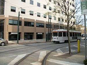
The Route 10 trolley before it enters the 36th Street Portal. | |
| Overview | |
| System | Subway-Surface Trolley Lines |
| Termini |
Overbrook, Philadelphia Center City, Philadelphia |
| Stations | 8 |
| Operation | |
| Depot(s) | Callowhill Depot |
| Technical | |
| Line length | 11.6 mi (18.7 km) |
| Track gauge | 5 ft 2 1⁄4 in (1,581 mm)[1][2] |
| Electrification | overhead lines |
SEPTA's Subway-Surface Trolley Route 10 (a.k.a.; the Lancaster Avenue-Subway Line) is a trolley line operated by the Southeastern Pennsylvania Transportation Authority (SEPTA) that connects the 13th Street station in downtown Philadelphia, Pennsylvania, to the Overbrook Loop (a.k.a.; Malvern Loop) station in the Overbrook section of West Philadelphia. It is one out of five lines that is part of the Subway-Surface Trolley system, and is 11.6 mi (18.7 km) long.
Route description
Starting from its eastern terminus at 13th Street, Route 10 runs in a subway tunnel under Market Street. It has underground station stops at 15th Street, 19th Street, 22nd Street, 30th Street, and 33rd Street. From 15th to 30th Streets, it runs on the outer tracks of the Market Street Subway Tunnel used by SEPTA's Market–Frankford Line. Passengers may transfer free of charge to the Market–Frankford Line at 13th Street, 15th Street, and 30th Street and to the Broad Street Line at 15th Street. Connections to the SEPTA Regional Rail can be made at 30th Street. There is an underground passageway that connects the ex-Pennsylvania Railroad's 30th Street Station to the Market-Frankford Line's 30th Street Subway Station, but this has long been sealed off due to high crime. An underground passageway continues to serve between the 13th and 15th Streets stations and Jefferson Station and Suburban Station, respectively.
Route 10 exits the subway at the 36th Street Portal, where as the other Subway-Surface Routes (11, 13, 34, and 36) surface at the 40th Street Portal. Route 10 then runs north on 36th Street, passing the former University City High School (now demolish) and University City Science Center as it approaches Lancaster Avenue (US 30). At Lancaster Avenue there is a wye cutback, which at one point connected to the former Subway-Surface Trolley Route 38 to Lancaster Avenue when the Route 10 Line continued straight down Lancaster Avenue to Market Street, where it connected to a now-closed subway entrance at 23rd & Market Streets.
Continuing northwest on Lancaster Avenue, the Route 10 line crosses over 40th Street, where there is a southbound track which diverts Route 10 to 40th & Market Streets MFL station when the trolley subway tunnel is closed. At 41st Street there is a northbound track by which Route 10 returns from 40th & Market Streets Station. The tracks on 40th and 41st Streets continue north of Lancaster Avenue (part of the PTC Route 40 trolley line until September 9, 1956[3]) to Girard Avenue and connect to the Surface Streetcar Trolley Route 15.
Continuing northwest along Lancaster Avenue to 48th Street, Route 10 intersects Girard Avenue, where Trolley Route 15 trackage joins that of Route 10; as Girard is offset by Lancaster Avenue, the two routes briefly share tracks before Route 15 turns left to continue up Girard Avenue.
At 52nd Street the line reaches Lansdowne Avenue, where another cutback loop exists, installed in 1996 for emergency or schedule adjustments only. Route 10 turns west on Lansdowne Avenue and at 60th Street, where now-abandoned tracks end just short of the line. These tracks once belonged to SEPTA Bus Route 46 when it was a trolley line (abandoned on August 11, 1957[3]), and later served as pull-in/pull-out tracks for Route 10 before it was moved to SEPTA's Elmwood Depot. When Route 10 moved back to Callowhill Depot in the 2000s, trolleys pulled-in/pulled-out to Callowhill Depot via 63rd Street instead, using the outer end of Route 15 along with trackage which once belonged to the Route 41 trolley (abandoned on August 11, 1957,[3] and now served by SEPTA Bus Route 31, another former subway-surface line until 1949). Route 10 turns north from Lansdowne onto 63rd Street, on which the line continues until it finally reaches the Malvern Loop, which has two (formerly three) tracks, sharing the off-street loop with SEPTA Bus Route 46.
History
Route 10 was established sometime before 1887. In 1906, the line was integrated into the Subway-Surface Trolley System by the Philadelphia Rapid Transit Company and was extended to 63rd & Malvern Streets.[4]
Stations
All stations are in Philadelphia.
| Station | Other Lines | Notes |
|---|---|---|
| 13th Street | 11, 13, 34, 36 |
|
| 15th Street | 11, 13, 34, 36 |
|
| 19th Street | 11, 13, 34, 36 | |
| 22nd Street | 11, 13, 34, 36 |
|
| 30th Street | 11, 13, 34, 36 |
|
| 33rd Street | 11, 13, 34, 36 |
|
| 36th Street Portal | ||
| Overbrook Loop |
| |
References
- ↑ "The history of trolley cars and routes in Philadelphia". SEPTA. 1974-06-01. p. 2. Retrieved 2014-06-11.
An early city ordinance prescribed that all tracks were to have a gauge of 2' 2 1⁄4"
- ↑ Hilton, George W.; Due, John Fitzgerald (2000-01-01). The Electric Interurban Railways in America. Stanford University Press. Retrieved 2014-06-10.
- 1 2 3 Borgnis, Mervin E. (1995). An inside story of PRT & PTC. Pleasantville, New Jersey: Mervin E. Borgnis. pp. 168–169.
- ↑ 1974 SEPTA Trolleys Brochure