Sahagún, Córdoba
| Sahagún, Córdoba | |||
|---|---|---|---|
| Municipality and town | |||
| |||
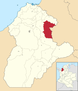 Location of the municipality and town of Sahagún, Córdoba in the Córdoba Department of Colombia. | |||
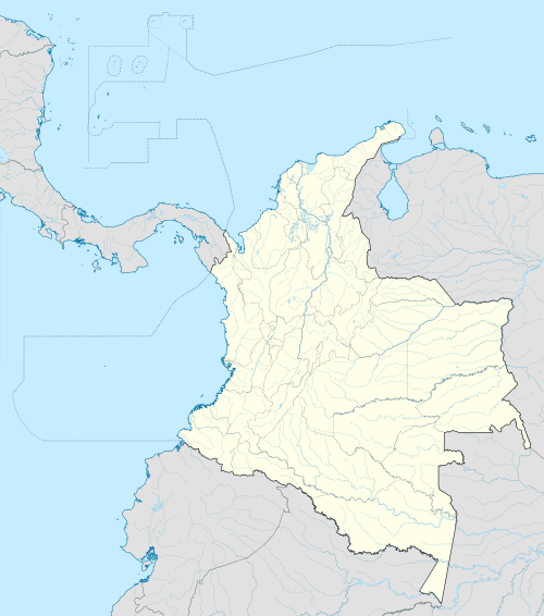 Sahagún, Córdoba Location in Colombia | |||
| Coordinates: CO 8°56′58″N 75°26′52″W / 8.94944°N 75.44778°W | |||
| Country |
| ||
| Department | Córdoba Department | ||
| Government | |||
| • Mayor | Carlos Alberto Elias Hoyos | ||
| Area | |||
| • Total | 992 km2 (383 sq mi) | ||
| Elevation | 71 m (233 ft) | ||
| Population (2012) | |||
| • Total | 50,460 | ||
| • Density | 51/km2 (130/sq mi) | ||
| Demonym(s) | Sahagunese | ||
| Time zone | Colombia Standard Time (UTC-5) | ||
| Area code(s) | 57 + 4 | ||
| Website | Official website (Spanish) | ||
.svg.png)

Sahagún (Spanish pronunciation: [saˈaɣun]) is a town and municipality located in the Córdoba Department, northern Colombia.
Climate
| Climate data for Sahagún, Córdoba | |||||||||||||
|---|---|---|---|---|---|---|---|---|---|---|---|---|---|
| Month | Jan | Feb | Mar | Apr | May | Jun | Jul | Aug | Sep | Oct | Nov | Dec | Year |
| Record high °C (°F) | 37 (99) |
42 (108) |
42 (108) |
40 (104) |
37 (99) |
37 (99) |
42 (108) |
35 (95) |
35 (95) |
37 (99) |
37 (99) |
37 (99) |
42 (108) |
| Average high °C (°F) | 31 (88) |
31 (88) |
32 (90) |
32 (90) |
32 (90) |
31 (88) |
31 (88) |
31 (88) |
30 (86) |
30 (86) |
30 (86) |
30 (86) |
31 (88) |
| Average low °C (°F) | 26 (79) |
26 (79) |
26 (79) |
26 (79) |
26 (79) |
26 (79) |
27 (81) |
26 (79) |
25 (77) |
25 (77) |
26 (79) |
26 (79) |
26 (79) |
| Record low °C (°F) | 18 (64) |
18 (64) |
18 (64) |
21 (70) |
17 (63) |
16 (61) |
17 (63) |
20 (68) |
21 (70) |
21 (70) |
17 (63) |
16 (61) |
16 (61) |
| Source: [1] | |||||||||||||
References
- ↑ "Weatherbase". Retrieved 17 September 2014.
- (Spanish) Gobernacion de Cordoba - Sahagún
- (Spanish) Sahagún official website
Coordinates: 8°57′N 75°27′W / 8.950°N 75.450°W
This article is issued from Wikipedia - version of the 11/13/2016. The text is available under the Creative Commons Attribution/Share Alike but additional terms may apply for the media files.