Saint-Antoine-de-l'Isle-aux-Grues
| Saint-Antoine-de-l'Isle-aux-Grues | |
|---|---|
| Parish municipality | |
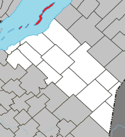 Location within La Matapédia RCM. | |
 Saint-Antoine-de-l'Isle-aux-Grues Location in province of Quebec. | |
| Coordinates: 47°04′N 70°33′W / 47.067°N 70.550°WCoordinates: 47°04′N 70°33′W / 47.067°N 70.550°W[1] | |
| Country |
|
| Province |
|
| Region | Chaudière-Appalaches |
| RCM | Montmagny |
| Constituted | January 1, 1860 |
| Government[2] | |
| • Mayor | Frédéric Poulin |
| • Federal riding |
Montmagny—L'Islet— Kamouraska—Rivière- du-Loup |
| • Prov. riding | Côte-du-Sud |
| Area[2][3] | |
| • Total | 24.10 km2 (9.31 sq mi) |
| • Land | 24.82 km2 (9.58 sq mi) |
|
There is an apparent contradiction between two authoritative sources | |
| Population (2011)[3] | |
| • Total | 146 |
| • Density | 5.9/km2 (15/sq mi) |
| • Pop 2006-2011 |
|
| • Dwellings | 115 |
| Time zone | EST |
| • Summer (DST) | EDT (UTC) |
| Postal code(s) | G0R 1P0 |
| Area code(s) | 418 and 581 |
| Highways | No major routes |
| Website |
www |
Saint-Antoine-de-l'Isle-aux-Grues is a parish municipality in Quebec, in the Montmagny Regional County Municipality in the administrative region of Chaudière-Appalaches. It is known for bird-watching, goose-hunting and cheeses.
Transportation
L'Isle-aux-Grues has a small airstrip, which provides the only access to the island during the winter, with Air Montmagny the main airline. A ferry operates during the summer months.[4]
Education
Children from Isle-aux-Grues attend school in Montmagny, Quebec, travelling by plane each day.[4]
2010 plane crash
On May 19, 2010 at about 3:30 p.m. Eastern time, a Cessna 172 airplane carrying four people crashed on Isle-aux-Grues, killing three people.[4]
See also
References
- ↑ Reference number 55640 of the Commission de toponymie du Québec (French)
- 1 2 Geographic code 18070 in the official Répertoire des municipalités (French)
- 1 2 "(Code 2418070) Census Profile". 2011 census. Statistics Canada. 2012.
- 1 2 3 White, Marianne (May 19, 2010). "Small plane crashes into Quebec island, 3 dead". The Gazette. Montreal. Canwest News Service. Retrieved May 19, 2010.
External links
 |
Sault-au-Cochon Saint Lawrence River |
Saint Lawrence River / Petite-Rivière-Saint-François | | |
| Saint-François-de-l'Île-d'Orléans / Saint Lawrence River | |
Saint Lawrence River / Saint-Jean-Port-Joli | ||
| ||||
| | ||||
| Berthier-sur-Mer / Saint Lawrence River | Saint Lawrence River Montmagny / Cap-Saint-Ignace |
Saint Lawrence River / L'Islet |
| Cities & Towns | |
|---|---|
| Municipalities | |
| Parishes | |
| |
This article is issued from Wikipedia - version of the 7/3/2013. The text is available under the Creative Commons Attribution/Share Alike but additional terms may apply for the media files.