Saint-Pierre-de-la-Rivière-du-Sud, Quebec
| Saint-Pierre-de-la-Rivière-du-Sud | |
|---|---|
| Parish municipality | |
 Location within La Matapédia RCM. | |
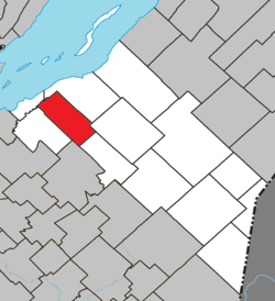
 Saint-Pierre-de-la-Rivière-du-Sud Location in province of Quebec. | |
| Coordinates: 46°55′N 70°38′W / 46.917°N 70.633°WCoordinates: 46°55′N 70°38′W / 46.917°N 70.633°W[1] | |
| Country |
|
| Province |
|
| Region | Chaudière-Appalaches |
| RCM | Montmagny |
| Constituted | July 1, 1855 |
| Government[2] | |
| • Mayor | Marie Eve Proulx |
| • Federal riding |
Montmagny—L'Islet— Kamouraska—Rivière- du-Loup |
| • Prov. riding | Côte-du-Sud |
| Area[2][3] | |
| • Total | 91.60 km2 (35.37 sq mi) |
| • Land | 93.44 km2 (36.08 sq mi) |
|
There is an apparent contradiction between two authoritative sources | |
| Population (2011)[3] | |
| • Total | 920 |
| • Density | 9.8/km2 (25/sq mi) |
| • Pop 2006-2011 |
|
| • Dwellings | 434 |
| Postal code(s) | G0R 4B0 |
| Area code(s) | 418 and 581 |
| Highways |
|
| Website |
www rivieresud |
Saint-Pierre-de-la-Rivière-du-Sud is a parish municipality in Quebec.
See also
References
 |
Berthier-sur-Mer | Montmagny | | |
| Saint-François-de-la-Rivière-du-Sud | |
Notre-Dame-du-Rosaire | ||
| ||||
| | ||||
| Armagh | Sainte-Euphémie-sur-Rivière-du-Sud |
| Cities & Towns | |
|---|---|
| Municipalities | |
| Parishes | |
| |
This article is issued from Wikipedia - version of the 11/8/2014. The text is available under the Creative Commons Attribution/Share Alike but additional terms may apply for the media files.