Saint-Eusèbe, Quebec
| Saint-Eusèbe | |
|---|---|
| Parish municipality | |
 | |
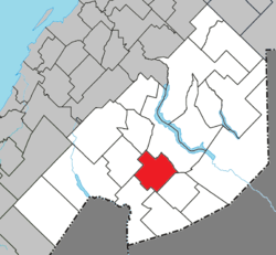 Location within Témiscouata RCM | |
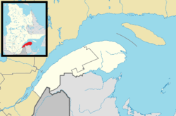 Saint-Eusèbe Location in eastern Quebec | |
| Coordinates: 47°33′N 68°55′W / 47.550°N 68.917°WCoordinates: 47°33′N 68°55′W / 47.550°N 68.917°W[1] | |
| Country |
|
| Province |
|
| Region | Bas-Saint-Laurent |
| RCM | Témiscouata |
| Constituted | January 5, 1911 |
| Government[2] | |
| • Mayor | Gaston Chouinard |
| • Federal riding |
Rimouski-Neigette— Témiscouata—Les Basques |
| • Prov. riding | Rivière-du-Loup-Témiscouata |
| Area[2][3] | |
| • Total | 131.00 km2 (50.58 sq mi) |
| • Land | 129.46 km2 (49.98 sq mi) |
| Population (2011)[3] | |
| • Total | 614 |
| • Density | 4.7/km2 (12/sq mi) |
| • Pop 2006-2011 |
|
| • Dwellings | 277 |
| Time zone | EST (UTC−5) |
| • Summer (DST) | EDT (UTC−4) |
| Postal code(s) | G0L 2Y0 |
| Area code(s) | 418 and 581 |
| Highways |
|
Saint-Eusèbe is a parish municipality in Quebec, Canada. It was established in 1911.[2]
See also
References
- ↑ Reference number 56478 of the Commission de toponymie du Québec (French)
- 1 2 3 "Répertoire des municipalités, "Saint-Eusèbe"". Gouvernement du Québec. 2010. Retrieved December 21, 2011.
- 1 2 "(Code 2413030) Census Profile". 2011 census. Statistics Canada. 2012.
External links
 Media related to Saint-Eusèbe, Quebec at Wikimedia Commons
 |
Saint-Elzéar-de-Témiscouata | Saint-Louis-du-Ha! Ha! | Témiscouata-sur-le-Lac | |
| |
||||
| ||||
| | ||||
| Rivière-Bleue | Saint-Marc-du-Lac-Long | Packington |
| Cities & Towns | |
|---|---|
| Municipalities | |
| Parishes | |
| |
This article is issued from Wikipedia - version of the 12/1/2016. The text is available under the Creative Commons Attribution/Share Alike but additional terms may apply for the media files.