Saint-Germain-lès-Arpajon
| Saint-Germain-lès-Arpajon | ||
|---|---|---|
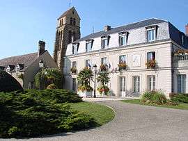
|
The town hall and church in Saint-Germain-lès-Arpajon | ||
| ||
 Saint-Germain-lès-Arpajon | ||
|
Location within Île-de-France region  Saint-Germain-lès-Arpajon | ||
| Coordinates: 48°35′41″N 2°15′21″E / 48.5946°N 2.2558°ECoordinates: 48°35′41″N 2°15′21″E / 48.5946°N 2.2558°E | ||
| Country | France | |
| Region | Île-de-France | |
| Department | Essonne | |
| Arrondissement | Palaiseau | |
| Canton | Arpajon | |
| Intercommunality | Arpajonnais | |
| Government | ||
| • Mayor (2008–2014) | Monique Goguelat | |
| Area1 | 6.31 km2 (2.44 sq mi) | |
| Population (2006)2 | 9,218 | |
| • Density | 1,500/km2 (3,800/sq mi) | |
| Time zone | CET (UTC+1) | |
| • Summer (DST) | CEST (UTC+2) | |
| INSEE/Postal code | 91552 / 91180 | |
| Elevation |
42–101 m (138–331 ft) (avg. 82 m or 269 ft) | |
|
1 French Land Register data, which excludes lakes, ponds, glaciers > 1 km² (0.386 sq mi or 247 acres) and river estuaries. 2 Population without double counting: residents of multiple communes (e.g., students and military personnel) only counted once. | ||
.svg.png)
Saint-Germain-lès-Arpajon is a commune in the Essonne department. It is a suburb of Paris located 30 km (19 mi) south of Paris via the N20, and 20 km (12 mi) north of Étampes.
Its inhabitants are called Germinois.
History
- Corbinian founded a religious community in the 7th century
- Up into the 13th century, Saint-Germain was a dependence of the châtellenie of Montlhéry
- In the 16th century, Saint-Germain was an estate of the lords of Granville
- In the 18th century, it was an estate of the lords of Noailles
- In 1720, the commune takes its current name following the acquisition of the commune of Châtres by Louis de Severac, Marquis d' Arpajon-sur-Cère (father of Anne d'Arpajon, comtesse de Noailles). It was previously called Saint-Germain-lès-Châtres).
See also
References
- INSEE
- Mayors of Essonne Association (French)
External links
| Wikimedia Commons has media related to Saint-Germain-lès-Arpajon. |
- Official website (French)
- Mérimée database - Cultural heritage (French)
- Land use (IAURIF) (English)
This article is issued from Wikipedia - version of the 2/11/2016. The text is available under the Creative Commons Attribution/Share Alike but additional terms may apply for the media files.