Saint-Godefroi, Quebec
| Saint-Godefroi | |
|---|---|
| Township municipality | |
|
Harbour at Saint-Godefroi | |
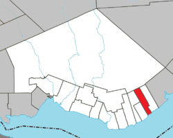 Location within Bonaventure RCM. | |
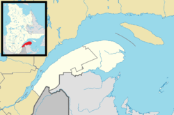 Saint-Godefroi Location in eastern Quebec. | |
| Coordinates: 48°05′N 65°07′W / 48.083°N 65.117°WCoordinates: 48°05′N 65°07′W / 48.083°N 65.117°W[1] | |
| Country |
|
| Province |
|
| Region |
Gaspésie– Îles-de-la-Madeleine |
| RCM | Bonaventure |
| Constituted | December 16, 1913 |
| Government[2] | |
| • Mayor | Gérard-Raymond Blais |
| • Federal riding |
Gaspésie— Îles-de-la-Madeleine |
| • Prov. riding | Bonaventure |
| Area[2][3] | |
| • Total | 63.60 km2 (24.56 sq mi) |
| • Land | 64.41 km2 (24.87 sq mi) |
|
There is an apparent contradiction between two authoritative sources | |
| Population (2011)[3] | |
| • Total | 405 |
| • Density | 6.3/km2 (16/sq mi) |
| • Pop 2006-2011 |
|
| • Dwellings | 217 |
| Time zone | EST (UTC−5) |
| • Summer (DST) | EDT (UTC−4) |
| Postal code(s) | G0C 3C0 |
| Area code(s) | 418 and 581 |
| Highways |
|

Saint-Godefroi is a township municipality in the Canadian province of Quebec, located within the Bonaventure Regional County Municipality. The township had a population of 405 in the Canada 2011 Census.
It is situated on the north shore of Chaleur Bay along Quebec Route 132. In addition to Saint-Godefroi itself, the township also includes the community of Kelly.
Demographics
Population
| Canada census – Saint-Godefroi, Quebec community profile | |||
|---|---|---|---|
| 2011 | 2006 | 2001 | |
| Population: | 405 (+9.5% from 2006) | 370 (-0.8% from 2001) | 373 (-23.6% from 1996) |
| Land area: | 64.41 km2 (24.87 sq mi) | 64.41 km2 (24.87 sq mi) | 64.41 km2 (24.87 sq mi) |
| Population density: | 6.3/km2 (16/sq mi) | 5.7/km2 (15/sq mi) | 5.8/km2 (15/sq mi) |
| Median age: | 54.6 (M: 53.4, F: 55.3) | 54.5 (M: 55.0, F: 54.0) | 50.8 (M: 49.8, F: 51.6) |
| Total private dwellings: | 217 | 205 | 207 |
| Median household income: | $.N/A | $35,732 | $25,553 |
| Notes: 2011 income data for this area has been suppressed for data quality or confidentiality reasons. – References: 2011[3] 2006[4] 2001[5] | |||
| Historical Census Data - Saint-Godefroi, Quebec[6] | ||||||||||||||||||||||||||
|---|---|---|---|---|---|---|---|---|---|---|---|---|---|---|---|---|---|---|---|---|---|---|---|---|---|---|
|
|
| ||||||||||||||||||||||||
Language
Mother tongue:[7]
- English as first language: 6.8%
- French as first language: 87.8%
- English and French as first language: 0%
- Other as first language: 5.4%
See also
References
- ↑ Reference number 56676 of the Commission de toponymie du Québec (French)
- 1 2 "Saint-Godefroi". Répertoire des municipalités (in French). Ministère des Affaires municipales, des Régions et de l'Occupation du territoire. Retrieved 2011-12-22.
- 1 2 3 "Saint-Godefroi census profile". 2011 Census data. Statistics Canada. Retrieved 2011-12-22.
- ↑ "2006 Community Profiles". Canada 2006 Census. Statistics Canada. March 30, 2011. Retrieved 2011-12-22.
- ↑ "2001 Community Profiles". Canada 2001 Census. Statistics Canada. February 17, 2012. Retrieved 2011-12-22.
- ↑ Statistics Canada: 1996, 2001, 2006, 2011 census
- ↑ "Saint-Godefroi community profile". 2006 Census data. Statistics Canada. Retrieved 2011-12-22.
 |
Rivière-Bonaventure | | ||
| Hope Township Hope Town |
|
Shigawake | ||
| ||||
| | ||||
| Chaleur Bay |
| Cities | |
|---|---|
| Municipalities | |
| Parishes | |
| Townships | |
| Unorganized Territories | |
| |
This article is issued from Wikipedia - version of the 11/3/2016. The text is available under the Creative Commons Attribution/Share Alike but additional terms may apply for the media files.