Saint-Magloire, Quebec
| Saint-Magloire | |
|---|---|
| Municipality | |
 | |
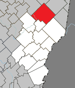 Location within Les Etchemins RCM. | |
 Saint-Magloire Location in southern Quebec. | |
| Coordinates: 46°35′N 70°17′W / 46.583°N 70.283°WCoordinates: 46°35′N 70°17′W / 46.583°N 70.283°W[1] | |
| Country |
|
| Province |
|
| Region | Chaudière-Appalaches |
| RCM | Les Etchemins |
| Constituted | January 1, 1875 |
| Government[2] | |
| • Mayor | Marielle Lemieux |
| • Federal riding | Lévis—Bellechasse |
| • Prov. riding | Bellechasse |
| Area[2][3] | |
| • Total | 208.70 km2 (80.58 sq mi) |
| • Land | 209.54 km2 (80.90 sq mi) |
|
There is an apparent contradiction between two authoritative sources | |
| Population (2011)[3] | |
| • Total | 725 |
| • Density | 3.5/km2 (9/sq mi) |
| • Pop 2006-2011 |
|
| • Dwellings | 446 |
| Time zone | EST (UTC−5) |
| • Summer (DST) | EDT (UTC−4) |
| Postal code(s) | G0R 3M0 |
| Area code(s) | 418 and 581 |
| Highways |
|
| Website |
www |
Saint-Magloire is a municipality in Les Etchemins Regional County Municipality in the Chaudière-Appalaches region of Quebec, Canada. Its population was 725 as of the Canada 2011 Census. It was named in tribute to reverend Joseph-Magloire Rioux, first priest of the parish in 1863.
Prior to August 16, 1997 it was known as Saint-Magloire-de-Bellechasse.[4]
References
- Commission de toponymie du Québec
- Ministère des Affaires municipales, des Régions et de l'Occupation du territoire
 |
Saint-Philémon | Saint-Paul-de-Montminy | Saint-Fabien-de-Panet | |
| Saint-Luc-de-Bellechasse | |
Saint-Just-de-Bretenières | ||
| ||||
| | ||||
| Sainte-Sabine | Saint-Camille-de-Lellis |
| Municipalities | |
|---|---|
| Parishes | |
| |
This article is issued from Wikipedia - version of the 2/28/2014. The text is available under the Creative Commons Attribution/Share Alike but additional terms may apply for the media files.