Saint Denis Street
| <span class="nickname" ">French: Rue Saint Denis | |
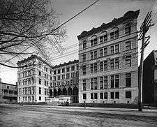
_2005-09-02.JPG) Saint Denis Street in the Quartier Latin | |
| Former name(s) | Rue Albert, rue Fénélon, rue Berri |
|---|---|
| Length | 11 km (7 mi) |
| Location | Montreal |
| South end | Saint-Antoine Street |
| North end | Rue Sommerville |
| Construction | |
| Inauguration | 1818 |
Saint Denis Street (officially in French: Rue Saint-Denis) is a major north-south thoroughfare in Montreal, Quebec.
It extends from the Notre-Dame-de-Bon-Secours Chapel on Saint Paul Street in Old Montreal to the bank of the Rivière des Prairies at the north end of the island. It is designated Route 335 from Sherbrooke Street to the Metropolitan Expressway, and is known as Bonsecours Street south of Saint Antoine Street. Along its length, it passes through the boroughs of Ville-Marie, Le Plateau-Mont-Royal, Rosemont–La Petite-Patrie, Villeray–Saint-Michel–Parc-Extension, and Ahuntsic-Cartierville.
Saint-Denis serves as one of the primary thoroughfares of both the Latin Quarter, where it plays host to a number of bars and restaurants, to the Plateau Mont-Royal, where it is known as one of the best places to view Montreal's distinct style of architecture. It becomes primarily a residential street north of the Metropolitan Expressway. The eastern portion of the Montreal Metro's Orange Line runs parallel to the street, two blocks to the east.
It is named for Saint Denis of Paris.
Route description
South of the Ville-Marie Expressway, the street crosses Old Montreal and is named rue Bonsecours. North of the Ville-Marie Expressway, it becomes Saint Denis Street and crosses the Quartier Latin. In the Quartier Latin, its vocation is primarily touristic and leisure-related, with restaurants and theatres located along this stretch. Near Saint Catherine Street, it crosses the downtown Université du Québec à Montréal (UQAM) campus while a little further north, it borders the Cégep du Vieux Montréal.
North of Sherbrooke Street, Saint Denis Street enters the borough of Le Plateau Mont-Royal. In the Plateau-Mont-Royal and Rosemont-La Petite-Patrie to the north, it is a commercial street lined with small stores. Parallel streets are mostly residential. To the west, Saint Laurent Boulevard also serves a commercial purpose.
In the boroughs of Villeray-Saint-Michel-Parc-Extension and Ahuntsic-Cartierville, Saint Denis Street is mainly residential. However, several businesses including green grocers and Vietnamese restaurants are located on the street. It is also one of the gateways to the Metropolitan Expressway. North of Crémazie Boulevard, it is a one-way northbound street with little traffic since the northbound Highway 335 continues along the Lajeunesse Street and Berri Street.
History
Saint Denis Street opened in the early nineteenth century on land acquired by Louis-Joseph Papineau (1786−1871) and his aunt Perine Charles Cherrier, widow of Denis Viger (1741−1805).
Extended several times, Saint Denis Street developed gradually after the construction of Saint Jacques Cathedral in 1836, facing Place Pasteur. Subsequently, it reached Sherbrooke Street near the end of the 19th century. During the mid-nineteenth century, this tree-lined residential street was inhabited by several representatives of the French Canadian elite. Before the end of the century, it begun to transform into a commercial street, ascending slowly northward.
In the early 20th century, the section of the Saint Denis Street between Dorchester Street (now René Lévesque Boulevard) and Sherbrooke Street became the center of Montreal's francophone intellectual elite. Located in the area were the Université Laval à Montréal (current site of the pavilion Hubert Aquin, UQAM), the École Polytechnique de Montréal, the Saint-Sulpice Library and many bookstores. It was deserted by academics following the relocation of Université of Montreal and École Polytechnique on the northern slope of Mount Royal. From the late 1970s, the academic character of the neighbourhood returned with the construction of pavilions for the Université du Québec à Montréal, around the steeple of the old Saint Jacques Cathedral.
Bibliography
- Christiane Abboud (dir.), Les rues de Montréal, Répertoire historique, Montréal, Éditions du Méridien, 1995, 23 cm, 547 p. (ISBN 2-89415-139-X), p. 423.
External links
Coordinates: 45°30′51″N 73°33′40″W / 45.514059°N 73.56109°W