Orange Line (Montreal Metro)
| Orange Line / Ligne Orange | ||||||
|---|---|---|---|---|---|---|
 | ||||||
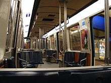
 Metro arriving at Lucien-L'Allier Station | ||||||
| Overview | ||||||
| Type | Rapid transit | |||||
| System | Montreal Metro | |||||
| Locale | Montreal, (QC), Canada. | |||||
| Termini |
Côte-Vertu Montmorency | |||||
| Stations | 31 | |||||
| Operation | ||||||
| Opened | October 14, 1966 | |||||
| Operator(s) | Société de transport de Montréal (STM) | |||||
| Depot(s) | Plateau d'Youville, Saint-Charles, Montmorency, Centre d'attachement Duvernay, Snowdon tail tracks and connecting track | |||||
| Rolling stock | Bombardier MR-73 cars, Bombardier MPM-10 (Azur) | |||||
| Technical | ||||||
| Line length | 30.0 km (18.6 mi) | |||||
| Track gauge | 1,435 mm (4 ft 8 1⁄2 in) standard gauge | |||||
| Electrification | "Third rail", 750 V DC on the guide bars at either side of the track | |||||
| Operating speed | 40 km/h (25 mph) | |||||
| ||||||
The Orange Line (French: Ligne orange), is the longest and first-planned of the four lines of the Montreal Metro in Montreal, Quebec, Canada. It formed part of the initial network, and was extended from 1980 to 1986. On April 28, 2007, three new stations in Laval opened making it the second line to leave Montreal Island.
The Orange Line measures 30 kilometres (19 mi) in length and counts 31 stations. It is the longest subway line in Montreal and the second-longest in Canada after the Line 1 Yonge–University of the Toronto subway. Like the rest of the Metro network, it is entirely underground. The line runs in a U-shape from Côte-Vertu in northwestern Montreal to Montmorency in Laval, northeast of Montreal.
History
The line was planned to run between Crémazie and Place-d'Armes.
Work on the Orange Line began on May 23, 1962 on Berri Street just south of Jarry Street.[1] In November 1962, the city of Montreal learned that it had been awarded the 1967 International and Universal Exposition (commonly known as Expo 67). To better meet the anticipated demand for transit during Expo 67, it was decided on August 6, 1963 to add the Sauvé and Henri-Bourassa stations in the north, and the Square-Victoria-OACI and Bonaventure stations in the south.
On October 14, 1966, the section between Henri-Bourassa and Place-d'Armes opened, forming part of the original Metro network. Completion of smaller sections were delayed by several months. On February 6, 1967, the segment from Place-d'Armes to Square-Victoria-OACI opened, followed on February 13, 1967, by Bonaventure.
Prior to the inauguration of the initial network, extensions were proposed in all directions, including the West Island. In its 1967 Urban Plan, entitled "Horizon 2000",[2] the city of Montreal planned to build a network of almost 100 miles (160 km) by the end of the twentieth century. On February 12, 1971, the council of the Montreal Urban Community authorized the borrowing of C$430 million to extend the Metro. This amount increased to C$665 million in 1973, and to C$1.6 billion in 1975. This expansion plan included the costs of extending the Orange Line westward, a distance of 20.5 kilometres (12.7 mi), adding 16 new stations, as well as the construction of a new garage.[3] The terminus station, Salaberry, would have been an intermodal station with Bois-Franc commuter rail station.
From the beginning, the plan was to expand the Metro to the northwest, but massive cost overruns on the expansion of the Green Line in preparation for the 1976 Summer Olympics, led to several years of delays, including a moratorium on underground expansions in 1976. To cut costs, three planned stations (Poirier, Bois-Franc, De Salaberry) and a maintenance workshop at the end of the track were eliminated.
In 1979, the Minister of Transport, Denis de Belleval, proposed to complete the subway extension to Du Collège and to extend the rest of the line above ground. This transportation plan was rejected by the mayors of the Montreal Urban Community. The moratorium was lifted in February 1981, with a new agreement that approved the construction of one additional station, Côte-Vertu. Du Collège was considered inappropriate to play the role of a terminus.
The western segment was constructed in the 1980s and was opened in several stages. On April 28, 1980, it was extended from Bonaventure to Place-Saint-Henri. From there, the line was extended to Snowdon on September 7, 1981, on 4 January 1982 to Côte-Sainte-Catherine, on June 29, 1982 to Plamondon, on January 9, 1984 to Du Collège, and finally on November 3, 1986 to the western terminus of Côte-Vertu.
Laval extension
After a break of more than two decades of expansion, the eastern segment was extended from Henri-Bourassa by three stations into the city of Laval. This 5.2 kilometres (3.2 mi) long section required digging a tunnel underneath the Rivière des Prairies. The three stations were, in order: Cartier, De la Concorde and Montmorency. Montmorency station is in proximity to Collège Montmorency and to the Laval campus of the Université de Montréal.
The Laval extension was inaugurated on April 26, 2007 and opened to the public on April 28, 2007. It was completely financed by the Government of Quebec, which mandated for the Agence métropolitaine de transport (AMT) to realize the project. The STM acted as a sub-contractor for the AMT, and was responsible for the installation of fixed equipment. This project extended the Orange Line by 5.2 kilometres (3.2 mi), 4.9 kilometres (3.0 mi) not including the depot past Montmorency, at a cost of roughly C$143.27 million per kilometre, which is slightly below the average cost for Metro extensions in other major cities. The total cost of the extension was C$745 million.[4] To this amount, C$12.4 million was added to the cost in 2008, to build a second entrance to Cartier station within Parc des Libellules, located northeast of Boulevard des Laurentides and Cartier. The three stations on the extension are wheelchair accessible, with elevators and other features to aid disabled persons, and are the first such stations on the Metro system. Since the stations opened, some of the older stations have been rebuilt to be made accessible, with more being rebuilt or planned to be rebuilt as funding permits.
Future extensions
In the medium term, there are plans for the Orange Line to be further extended toward the northwest from Côte-Vertu. This extension would include two new stations, Poirier and Bois-Franc. The latter would create a transportation hub with the existing station on the Agence métropolitaine de transport's Deux-Montagnes line.[5]
Following the extension of the line into Laval, Gilles Vaillancourt, former mayor of Laval, has suggested that a further six stations be added to the line. Three of these would be in Laval and three in Montreal, in order to create a loop out of the Orange Line.[6] Recently, Laval city proposed to add 8 more stations to the line, including 5 in Laval to complete the loop and to serve the Carrefour Laval terminus.[7]
Infrastructure
Maintenance
The Metro trains are stored in the Saint-Charles Garage, north of Henri-Bourassa station, and in the garage at Montmorency station for passenger cars. They are maintained at the Plateau d'Youville, which is located between Crémazie and Sauvé stations. Centre d'attachement Duvernay, which is connected to the Green Line, is used for maintenance of way equipment. The Snowdon tail tracks and connecting track, which is connected to the Blue Line, is also used for maintenance of way equipment.
Rolling stock
The MR-73 are the type of trains used on the Orange Line. Introduced in 1976, the MR-73 is the second generation of high-performance Metro cars, identified by rectangular cab headlights, blue and dark orange interiors, 124 kW (166 hp) traction motors that growl while accelerating out of a station, side vents, and a unique three-note sound signature when the train pulls out of a station.
The rolling stock on the Orange Line will be upgraded to MPM-10s starting in 2016. The MR-73 trains will be used thereafter on the Green Line, replacing the aging MR-63s.
List of stations
| Station | Inauguration date | Odonym | Namesake |
|---|---|---|---|
| Côte-Vertu | September 3, 1986 | Côte-Vertu Road | Notre-Dame-de-la-Vertu (Our Lady of Virtue), 18th century name for the area |
| Du Collège | January 9, 1984 | Du Collège Street | Cégep de Saint-Laurent, local cégep |
| De La Savane | De la Savane Street | savane - a savanna or Québécois for swamp | |
| Namur | Namur Street | Namur, Belgium | |
| Plamondon | June 29, 1982 | Plamondon Avenue | Antoine Plamondon, Québécois painter, or Rodolphe Plamondon,[8] Québécois lyric artist |
| Côte-Sainte-Catherine | January 4, 1982 | Côte-Sainte-Catherine Road | Côte Sainte-Catherine, 18th century name for area of Outremont |
| Snowdon | September 7, 1981 (Orange Line) January 4, 1988 (Blue Line) |
Snowdon Street; Snowdon neighbourhood | Name of area's former landowner |
| Villa-Maria | September 7, 1981 | Villa-Maria High School | Latin form of "Ville-Marie," former name of Montreal |
| Vendôme | De Vendôme Avenue | Likely from the French Dukes of Vendôme | |
| Place-Saint-Henri | April 28, 1980 | Place Saint-Henri | A parish church named for Saint Henry II, to commemorate Fr. Henri-Auguste Roux |
| Lionel-Groulx | September 3, 1978 (Green Line)
April 28, 1980 (Orange Line) |
Lionel-Groulx Avenue | Fr. Lionel Groulx, Quebec historian |
| Georges-Vanier | April 28, 1980 | Georges-Vanier Boulevard | Georges Vanier, Governor General of Canada |
| Lucien-L'Allier | Lucien-L'Allier Street | Lucien L'Allier, General Manager of the Transit Commission when the Metro opened | |
| Bonaventure | February 13, 1967 | Place Bonaventure | Bonaventure Station, in turn for former Bonaventure Street; St. Bonaventure, Italian cleric |
| Square-Victoria-OACI | February 7, 1967 | Victoria Square; | Queen Victoria;
Nearby Headquarters of ICAO |
| Place-d'Armes | October 14, 1966 | Place d'Armes | Historical rallying point for city's defenders |
| Champ-de-Mars | Champ de Mars Park | Common term for military exercise ground (Mars, god of war) | |
| Berri-UQAM | October 14, 1966 (Green Line and Orange Line)
April 1, 1967 (Yellow Line) |
Berri Street;
Université du Québec à Montréal; De Montigny Street |
Name given by Migeon de Branssat in 1669; named for Simon Després dit Le Berry;
Testard de Montigny family |
| Sherbrooke | October 14, 1966 | Sherbrooke Street | John Coape Sherbrooke, Governor-general of British North America |
| Mont-Royal | Mount Royal Avenue | Mount Royal | |
| Laurier | Laurier Avenue | Wilfrid Laurier, Prime Minister of Canada | |
| Rosemont | Rosemont Boulevard; Rosemont neighbourhood | Named by developer U.-H. Dandurand for his mother, née Rose Phillips | |
| Beaubien | Beaubien Street | Prominent landowning family | |
| Jean-Talon | October 14, 1966 (Orange Line) June 16, 1986 (Blue Line) |
Jean Talon Street | Jean Talon, intendant of New France |
| Jarry | October 14, 1966 | Jarry Street | Stanislas Blénier dit Jarry père, landowner or Honoré-Bernard Bleignier Jarry |
| Crémazie | Crémazie Boulevard | Octave Crémazie, Quebec poet | |
| Sauvé | Sauvé Street | Name of a landowner | |
| Henri-Bourassa | Henri Bourassa Boulevard | Henri Bourassa, Québécois journalist and politician | |
| Cartier | April 28, 2007 | Cartier Boulevard | Sir George-Étienne Cartier Québécois politician, Father of Confederation |
| De La Concorde | April 28, 2007 | De la Concorde Boulevard | Place de la Concorde in Paris |
| Montmorency | April 28, 2007 | Collège Montmorency | François de Montmorency-Laval, first Roman Catholic Bishop of Quebec and landowner of Île Jésus (Laval) |
See also
References
- ↑ Guimont, Marc (2007). Montréal en métro (in French) (2 ed.). Montreal, Quebec, Canada: Guides de voyage Ulysse inc. p. 8. ISBN 978-2-89464-782-0.
- ↑ "Horizon 2000". Ville de Montréal (in French). YouTube. 1967. Retrieved 9 September 2012.
- ↑ Gaston, J., Le métro de Montréal, Montréal : Communauté urbaine de Montréal, Bureau de transport métropolitain, 1976 p.61,
- ↑ "Laval Metro Expansion". Agence métropolitaine de transport. Archived from the original on May 6, 2013.
- ↑ "Plan de transport — Le métro" (in French). Ville de Montréal. Retrieved 7 September 2012.
- ↑ St-Amour, Stéphane (July 22, 2007). "Montréal a bien d'autres priorités". Courrier Laval (in French).
- ↑ St-Amour, Stéphane (May 26, 2011). "Métro: Laval réclame cinq nouvelles stations". Courrier Laval (in French).
- ↑ McMillan, Barclay; Keillor, Elaine (February 25, 2015). "Joseph-Marcel-Rodolphe Plamondon". The Canadian Encyclopedia.
External links
| Line 1 Green | |
|---|---|
| Line 2 Orange |
|
| Line 4 Yellow | |
| Line 5 Blue | |
| Crossings of the Rivière des Prairies | |
|---|---|