Sainte-Flavie, Quebec
| Sainte-Flavie | |
|---|---|
| Parish municipality | |
|
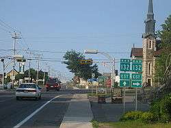
Route 132 split in Sainte-Flavie | |
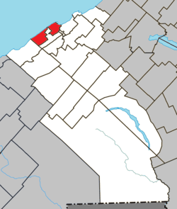 Location within La Mitis RCM | |
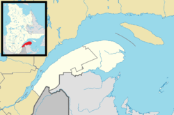 Sainte-Flavie Location in eastern Quebec | |
| Coordinates: 48°37′00″N 68°14′00″W / 48.6167°N 68.2333°WCoordinates: 48°37′00″N 68°14′00″W / 48.6167°N 68.2333°W[1] | |
| Country |
|
| Province |
|
| Region | Bas-Saint-Laurent |
| RCM | La Mitis |
| Constituted | July 1, 1855 |
| Named for | Saint Flavia[1] |
| Government[2] | |
| • Mayor | Damien Ruest |
| • Federal riding | Haute-Gaspésie—La Mitis—Matane—Matapédia |
| • Prov. riding | Matane-Matapédia |
| Area[2][3] | |
| • Total | 38.30 km2 (14.79 sq mi) |
| • Land | 37.82 km2 (14.60 sq mi) |
| Population (2011)[3] | |
| • Total | 919 |
| • Density | 24.3/km2 (63/sq mi) |
| • Pop 2006-2011 |
|
| • Dwellings | 505 |
| Demonym(s) | Flavien, Flavienne |
| Time zone | EST (UTC−5) |
| • Summer (DST) | EDT (UTC−4) |
| Postal code(s) | G0J 2L0 |
| Area code(s) | 418 and 581 |
| Highways |
|
| Website |
www |
Sainte-Flavie is a parish municipality in the La Mitis Regional County Municipality of Quebec, Canada, located on the south shore of the Saint Lawrence River, about 3 km (2 mi) northwest of Mont-Joli. It is named after Flavia, a martyred saint.
Sainte-Flavie is the westernmost point of Route 132's loop around the Gaspé Peninsula; it is here where the highway intersects with itself.
See also
References
External links
-
 Media related to Sainte-Flavie, Quebec at Wikimedia Commons
 |
Saint Lawrence River | | ||
| Sainte-Luce | |
Grand-Métis | ||
| ||||
| | ||||
| Mont-Joli | Price |
| Cities & Towns | |
|---|---|
| Municipalities | |
| Parishes | |
| Villages | |
| Unorganized territories | |
| |
This article is issued from Wikipedia - version of the 12/1/2016. The text is available under the Creative Commons Attribution/Share Alike but additional terms may apply for the media files.