Sainte-Marie-Salomé, Quebec
| Sainte-Marie-Salomé | |
|---|---|
| Parish municipality | |
| Nickname(s): Sainte-Marie | |
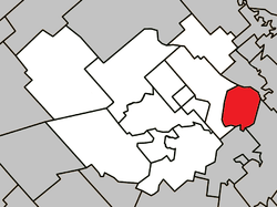 Location within Montcalm RCM. | |
 Sainte-Marie-Salomé Location in central Quebec. | |
| Coordinates: 45°56′N 73°30′W / 45.933°N 73.500°WCoordinates: 45°56′N 73°30′W / 45.933°N 73.500°W[1] | |
| Country |
|
| Province |
|
| Region | Lanaudière |
| RCM | Montcalm |
| Settled | 1765 |
| Constituted | December 27, 1888 |
| Government[2] | |
| • Mayor | Maurice Richard |
| • Federal riding | Montcalm |
| • Prov. riding | Joliette |
| Area[2][3] | |
| • Total | 33.50 km2 (12.93 sq mi) |
| • Land | 33.69 km2 (13.01 sq mi) |
|
There is an apparent contradiction between two authoritative sources | |
| Population (2011)[3] | |
| • Total | 1,164 |
| • Density | 34.5/km2 (89/sq mi) |
| • Pop 2006–2011 |
|
| Time zone | EST (UTC−5) |
| • Summer (DST) | EDT (UTC−4) |
| Postal code(s) | J0K 2Z0 |
| Area code(s) | 450 and 579 |
| Highways[4] | No major routes |
Sainte-Marie-Salomé is a parish municipality in the Lanaudière region of Quebec, Canada, part of the Montcalm Regional County Municipality.
History
In 1765, the first wave of colonization occurred as a result of the Great Upheaval when Acadians from Boston arrived and settled on the south bank of the Vacher Creek (French: ruisseau Vacher) in the Seignory of Saint-Sulpice. The settlement was called Bas-du-Ruisseau-Vacher (meaning "Lower Vacher Creek"), named after a certain Vacher who accompanied surveyor John Péladeau in 1767 on the seignory's territory. In 1790, the settlement grew when families from Château-Richer arrived. Actual clearing of the area began around 1820.[5]
In March 1883, Sainte-Marie-Salomé became home to the second creamery of Quebec.[5]
In 1888, the Parish Municipality of Sainte-Marie-Salomé was established by separating from Saint-Jacques-de-l'Achigan, and named after Mary Salome. Its letters patent used the misspelled "Salomée", which was not corrected until 1986. In 1889, the local post office opened. During the 1890s, the location was also known as Sainte-Marie-Salomé-de-Port-Royal, indicating the origin of its Acadian settlers.[5]
Economy
Being in the fertile land of the St. Lawrence Lowlands, agriculture is the most important economic function of the municipality.[6]
Demographics
Population trend:[7]
- Population in 2011: 1164 (2006 to 2011 population change: -7.3%)
- Population in 2006: 1256
- Population in 2001: 1166
- Population in 1996: 1189
- Population in 1991: 1116
Private dwellings occupied by usual residents: 474 (total dwellings: 508)
Mother tongue:
- English as first language: 0.8%
- French as first language: 97.6%
- English and French as first language: 0.8%
- Other as first language: 0.8%
References
- ↑ Reference number 183476 of the Commission de toponymie du Québec (French)
- 1 2 Geographic code 63005 in the official Répertoire des municipalités (French)
- 1 2 Statistics Canada 2011 Census - Sainte-Marie-Salomé census profile
- ↑ Official Transport Quebec Road Map
- 1 2 3 "Sainte-Marie-Salomé (Municipalité de paroisse)" (in French). Commission de toponymie du Québec. Retrieved 2009-10-05.
- ↑ "La municipalité de Sainte-Marie-Salomé" (in French). Centre local de développement Montcalm. Retrieved 2009-10-05.
- ↑ Statistics Canada: 1996, 2001, 2006, 2011 census
External links
 |
Crabtree | | ||
| Saint-Jacques | |
L'Assomption | ||
| ||||
| | ||||
| L'Épiphanie (parish) |
| Cities/towns | |
|---|---|
| Municipalities | |
| Parishes | |
| |