Salsk
| Salsk (English) Сальск (Russian) | |
|---|---|
| - Town[1] - | |
 On the Lenina Street in central Salsk | |
.svg.png) Location of Rostov Oblast in Russia | |
 Salsk | |
|
| |
.png) |
|
|
| |
| Administrative status (as of October 2012) | |
| Country | Russia |
| Federal subject | Rostov Oblast[1] |
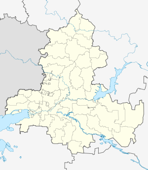
| Administrative district | Salsky District[1] |
| Urban settlement | Salskoye[1] |
| Administrative center of | Salsky District,[1] Salskoye Urban Settlement[1] |
| Municipal status (as of December 2004) | |
| Municipal district | Salsky Municipal District[2] |
| Urban settlement | Salskoye Urban Settlement[2] |
| Administrative center of | Salsky Municipal District,[2] Salskoye Urban Settlement[2] |
| Statistics | |
| Population (2010 Census) | 61,316 inhabitants[3] |
| Time zone | MSK (UTC+03:00)[4] |
| Founded | 1899 |
| Town status since | 1926 |
| Previous names | Torgovaya (until 1926) |
| Postal code(s)[5] | 347630–347634, 347636, 347639, 347640, 347649, 347659 |
|
| |
| Salsk on Wikimedia Commons | |
Salsk (Russian: Сальск) is a town and the administrative center of Salsky District in Rostov Oblast, Russia, located on the Sredny Yegorlyk River (Don's basin), 180 kilometers (110 mi) southeast of Rostov-on-Don, the administrative center of the oblast. Population: 61,316 (2010 Census);[3] 61,775 (2002 Census);[6] 61,088 (1989 Census).[7]
History
![]() Russian Empire 1899–1917
Russian Empire 1899–1917
![]() Russian Republic 1917
Russian Republic 1917
![]() Soviet Russia 1917–1922
Soviet Russia 1917–1922
![]() Soviet Union 1922–1991
Soviet Union 1922–1991
![]() Russian Federation 1991–present
Russian Federation 1991–present
It was established as a settlement serving Torgovaya (Торго́вая) railway station, which opened in 1899. It was granted town status and renamed Salsk in 1926. Salsk was occupied by Nazi Germany from July 31, 1942 as a part of the operation known as Case Blue.
Administrative and municipal status
Within the framework of administrative divisions, Salsk serves as the administrative center of Salsky District.[1] As an administrative division, it is incorporated within Salsky District as Salskoye Urban Settlement.[1] As a municipal division, this administrative unit also has urban settlement status and is a part of Salsky Municipal District.[2]
References
Notes
- 1 2 3 4 5 6 7 8 Law #340-ZS
- 1 2 3 4 5 Law #233-ZS
- 1 2 Russian Federal State Statistics Service (2011). "Всероссийская перепись населения 2010 года. Том 1" [2010 All-Russian Population Census, vol. 1]. Всероссийская перепись населения 2010 года (2010 All-Russia Population Census) (in Russian). Federal State Statistics Service. Retrieved June 29, 2012.
- ↑ Правительство Российской Федерации. Федеральный закон №107-ФЗ от 3 июня 2011 г. «Об исчислении времени», в ред. Федерального закона №271-ФЗ от 03 июля 2016 г. «О внесении изменений в Федеральный закон "Об исчислении времени"». Вступил в силу по истечении шестидесяти дней после дня официального опубликования (6 августа 2011 г.). Опубликован: "Российская газета", №120, 6 июня 2011 г. (Government of the Russian Federation. Federal Law #107-FZ of June 31, 2011 On Calculating Time, as amended by the Federal Law #271-FZ of July 03, 2016 On Amending Federal Law "On Calculating Time". Effective as of after sixty days following the day of the official publication.).
- ↑ Почта России. Информационно-вычислительный центр ОАСУ РПО. (Russian Post). Поиск объектов почтовой связи (Postal Objects Search) (Russian)
- ↑ Russian Federal State Statistics Service (May 21, 2004). "Численность населения России, субъектов Российской Федерации в составе федеральных округов, районов, городских поселений, сельских населённых пунктов – районных центров и сельских населённых пунктов с населением 3 тысячи и более человек" [Population of Russia, Its Federal Districts, Federal Subjects, Districts, Urban Localities, Rural Localities—Administrative Centers, and Rural Localities with Population of Over 3,000] (XLS). Всероссийская перепись населения 2002 года [All-Russia Population Census of 2002] (in Russian). Retrieved August 9, 2014.
- ↑ Demoscope Weekly (1989). "Всесоюзная перепись населения 1989 г. Численность наличного населения союзных и автономных республик, автономных областей и округов, краёв, областей, районов, городских поселений и сёл-райцентров" [All Union Population Census of 1989: Present Population of Union and Autonomous Republics, Autonomous Oblasts and Okrugs, Krais, Oblasts, Districts, Urban Settlements, and Villages Serving as District Administrative Centers]. Всесоюзная перепись населения 1989 года [All-Union Population Census of 1989] (in Russian). Институт демографии Национального исследовательского университета: Высшая школа экономики [Institute of Demography at the National Research University: Higher School of Economics]. Retrieved August 9, 2014.
Sources
- Законодательное Собрание Ростовской области. Закон №340-ЗС от 25 июля 2005 г. «Об административно-территориальном устройстве Ростовской области», в ред. Закона №270-ЗС от 27 ноября 2014 г. «О внесении изменений в областной Закон "Об административно-территориальном устройстве Ростовской области"». Вступил в силу со дня официального опубликования. Опубликован: "Наше время", №187–190, 28 июля 2005 г. (Legislative Assembly of Rostov Oblast. Law #340-ZS of July 28, 2005 On the Administrative-Territorial Structure of Rostov Oblast, as amended by the Law #270-ZS of November 27, 2014 On Amending the Oblast Law "On the Administrative-Territorial Structure of Rostov Oblast". Effective as of the official publication date.).
- Законодательное Собрание Ростовской области. Закон №233-ЗС от 27 декабря 2004 г. «Об установлении границ и наделении соответствующим статусом муниципального образования "Сальский район" и муниципальных образований в его составе». Вступил в силу со дня официального опубликования. Опубликован: "Наше время", №№325–338, 28 декабря 2004 г. (Legislative Assembly of Rostov Oblast. Law #233-ZS of December 27, 2004 On Establishing the Borders and Granting an Appropriate Status to the Municipal Formation of "Salsky District" and to the Municipal Formations It Comprises. Effective as of the day of the official publication.).