San Rafael Reef
| San Rafael Reef | |
|---|---|
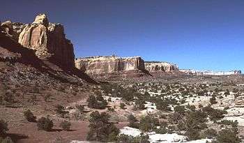 Western San Rafael Reef, Utah, looking south | |
| Highest point | |
| Coordinates | 38°55′19″N 110°26′17″W / 38.922°N 110.438°WCoordinates: 38°55′19″N 110°26′17″W / 38.922°N 110.438°W |
| Geography | |
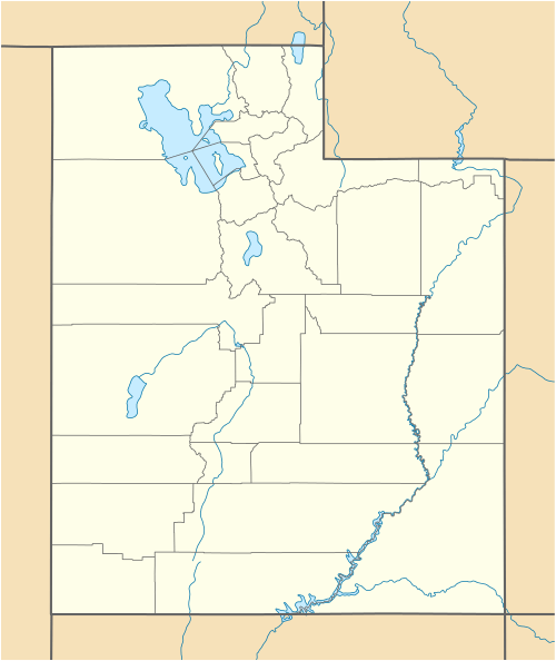 San Rafael Reef Location of the San Rafael Reef within Utah | |
| Location | Emery County, Utah |
The San Rafael Reef is a geologic feature located in Emery County in central Utah, part of the Colorado Plateau. Approximately 75 miles (120 km) long, it is the name given to the distinctive eastern edge of the San Rafael Swell. Composed primarily of steeply tilted layers of Navajo and Wingate Sandstone, it has been eroded into tall fins, domes, cliffs, and deep canyons.
The San Rafael River, Interstate 70, and Muddy Creek all cut through the San Rafael Reef. There are also numerous slot canyons that twist their way through the flanks of the San Rafael Reef, among them Crack Canyon, Chute Canyon and Straight Wash. These spectacularly beautiful canyons are often just a few feet wide and can be hundreds of feet deep. Much of the San Rafael Reef has been determined to possess wilderness characteristics and the Crack Canyon and Mexican Mountain Wilderness Study Areas, or WSAs, currently protect several thousand acres of the most worthy areas of the San Rafael Reef, and are awaiting hoped-for designation as BLM Wilderness by the Congress.
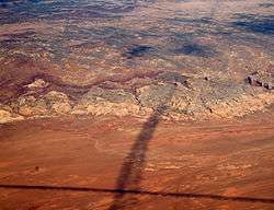 Shadows of contrails over San Rafael Reef —
San Rafael Swell, Reef (perimeter), and San Rafael Desert at south & southeast. The Reef is most of the southeast, and east perimeter of the 45-mi wide (west-to-east) San Rafael Swell (which trends southwest-by-northeast). Approach to the San Rafael Reef-(eastern end), from Interstate 70, which crosses through the Reef onto the San Rafael Swell, east-to-west looking.
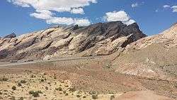 Interstate 70 cuts through the impressive San Rafael Reef from the east.
| Wikimedia Commons has media related to San Rafael Reef. |