San Ramón (canton)
| San Ramón | |||
|---|---|---|---|
| Canton | |||
 | |||
| |||
 Location of San Ramón Canton in Alajuela Province | |||
| Country | Costa Rica | ||
| Province | Alajuela | ||
| Founded | 21 August 1856 | ||
| Government | |||
| • Mayor | Mercedes Moya Araya (PLN) | ||
| Area | |||
| • Total | 1,018.64 km2 (393.30 sq mi) | ||
| Population (June 2013) | |||
| • Total | 86,312 | ||
| • Density | 85/km2 (220/sq mi) | ||
.svg.png)

San Ramón is the second canton in the province of Alajuela in Costa Rica. The canton covers an area of 1,018.64 square kilometres (393.30 sq mi),[1] and has a population of 86,312 (estimate as of 2013).[2]
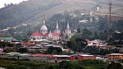
The capital city of the canton is also called San Ramón.
Geography
An oddly-shaped canton, San Ramon stretches north through the eastern heights of the Cordillera de Tilarán, looking down on the Central Valley (Valle Central) to its east. The canton forms the border with the province of Guanacaste to the west.
Districts
The canton of San Ramón is subdivided into 13 districts (distritos):[3]
- San Ramón
- Santiago
- San Juan
- Piedades Norte
- Piedades Sur
- San Rafael
- San Isidro
- Los Ángeles
- Alfaro
- Volio
- Concepción
- Zapotal
- Peñas Blancas
History
The canton was established by a decree of August 21, 1856.
References
- ↑ Instituto Geográfico Nacional (IGN), 2001.
- ↑ Estadísticas Vitales 2013 - INEC
- ↑ "División Territorial Administrativa de Costa Rica" (PDF) (in Spanish). Instituto de Fomento y Asesoria Municipal (IFAM). 5 May 2009.
Coordinates: 10°13′13″N 84°35′20″W / 10.22028°N 84.58889°W
This article is issued from Wikipedia - version of the 8/29/2016. The text is available under the Creative Commons Attribution/Share Alike but additional terms may apply for the media files.