Sangerhausen
| Sangerhausen | ||
|---|---|---|
|
Sangerhausen | ||
| ||
 Sangerhausen | ||
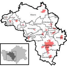
Location of Sangerhausen within Mansfeld-Südharz district  | ||
| Coordinates: 51°28′0″N 11°18′0″E / 51.46667°N 11.30000°ECoordinates: 51°28′0″N 11°18′0″E / 51.46667°N 11.30000°E | ||
| Country | Germany | |
| State | Saxony-Anhalt | |
| District | Mansfeld-Südharz | |
| Government | ||
| • Mayor | Ralf Poschmann (CDU) | |
| Area | ||
| • Total | 207.64 km2 (80.17 sq mi) | |
| Population (2015-12-31)[1] | ||
| • Total | 27,752 | |
| • Density | 130/km2 (350/sq mi) | |
| Time zone | CET/CEST (UTC+1/+2) | |
| Postal codes | 03464, 034656 (Großleinungen), 034658 (Breitenbach, Horla, Wolfsberg), 034775 (Wippra) | |
| Dialling codes | 03464 | |
| Vehicle registration | MSH, EIL, HET, ML, SGH | |
| Website | www.sangerhausen.de | |


Sangerhausen (German pronunciation: [zaŋɐˈhaʊzən]) is a town in Saxony-Anhalt, Germany, capital of the district of Mansfeld-Südharz, without being part of it. It is situated southeast of the Harz, approx. 35 kilometres (22 miles) east of Nordhausen, and 50 km (31 mi) west of Halle (Saale). About 31,000 people live in Sangerhausen.
History
![]() Margraviate of Meissen 1249–1291
Margraviate of Meissen 1249–1291
![]() Margraviate of Brandenburg 1291–1372
Margraviate of Brandenburg 1291–1372
![]() Electorate of Saxony 1372–1697
Electorate of Saxony 1372–1697
![]() Poland-Saxony 1697–1706
Poland-Saxony 1697–1706
![]() Electorate of Saxony 1706–1709
Electorate of Saxony 1706–1709
![]() Poland-Saxony 1709–1763
Poland-Saxony 1709–1763
![]() Electorate of Saxony 1763–1806
Electorate of Saxony 1763–1806
![]() Kingdom of Saxony 1806–1815
Kingdom of Saxony 1806–1815
![]() Kingdom of Prussia 1815–1871
Kingdom of Prussia 1815–1871
![]() German Empire 1871–1918
German Empire 1871–1918
![]() Weimar Republic 1918–1933
Weimar Republic 1918–1933
![]() Nazi Germany 1933–1945
Nazi Germany 1933–1945
![]() Allied-occupied Germany 1945–1949
Allied-occupied Germany 1945–1949
![]() East Germany 1949–1990
East Germany 1949–1990
![]() Federal Republic of Germany 1990–present
Federal Republic of Germany 1990–present
Sangerhausen is one of the oldest towns in the historical region of Saxony-Anhalt, being mentioned in a document of 991 as appertaining to the estates of the emperor. By marriage it passed to the landgrave of Thuringia, and after 1056 it formed for a while an independent country. Having been again part of Thuringia, it fell in 1249 to Meissen, and in 1291 to Brandenburg. In 1372 it passed to the Electorate of Saxony and formed a portion of that territory until 1815, when it became a part of the Prussian Province of Saxony.
Municipality
.JPG)
The municipality of Sangerhausen currently includes the town itself plus 14 outlying villages, also called (in German) Ortschafte or Ortsteile. These are Breitenbach, Gonna, Grillenberg, Großleinungen, Horla, Lengefeld, Morungen, Oberröblingen, Obersdorf, Riestedt, Rotha, Wettelrode, Wippra and Wolfsberg.
In 1994, the town of Sangerhausen, at that time still an independent municipality, became part of the so-called Verwaltungsgemeinschaft Sangerhausen, a municipal association consisting of Sangerhausen itself and the two villages/municipalities Edersleben and Oberröblingen. On 29 April 2000 Edersleben left for the Verwaltungsgemeinschaft Helme. On 1 January 2005 the villages/municipalities Gonna, Grillenberg, Horla, Lengefeld, Morungen, Obersdorf, Pölsfeld, Rotha and Wettelrode joined the association from the Verwaltungsgemeinschaft Südharz which was dissolved. Six months later, on 3 July 2005 Pölsfeld left for the Verwaltungsgemeinschaft Allstedt-Kaltenborn.
On 1 Oct. 2005 the Verwaltungsgemeinschaft Sangerhausen, consisting then of 10 municipalities was dissolved and turned into the single town/municipality Sangerhausen; which meant that the 9 villages were truly annexed. On the same date Breitenbach, Großleinungen and Wolfsberg also joined, coming from the municipal association Roßla-Südharz. On 1 December 2005 Riestedt followed, coming from the Verwaltungsgemeinschaft Allstedt-Kaltenborn. Finally, Wippra was incorporated on 1 January 2008, coming from the Verwaltungsgemeinschaft Wipper-Eine.
Main sights
- Altes Rathaus ("Old Town Hall"), erected in 1431-1437 after a previous edifice burned down in 1358.
- Church of St. Mary (Marienkirche), built in 1350 in Gothic style
- Church of St. James (Jakobikirche, 1457-1542), a late Gothic hall edifice with a nave and three aisles. It has a 61 m-high, slightly tilting bell tower with a Baroque cover. The interior has a rich decoration painted by Georg Bottschild in 1665, while the choir stalls and the high altar are from an Augustinian monastery closed in 1539. It also houses numerous tombs and effigies. Johann Sebastian Bach applied here in 1702 for the post of organist, but the job went to Johann Augustin Kobelius.
- Church of St. Ulrich (Ulrichkirche), one of the most interesting Romanesque edifices in Germany. It is a basilica built in 1116-1123, with a bell tower added in the 15th century. It has a nave and two aisles with groin vault. The eastern part has five apses.
- The Altes Schloss ("Old Castle"), built by the lords of Meissen. Only a tower remains. The New Palace or Neues Schloss was built by Kaspar Tryller, minister of Finances of the Electorate of Saxony, from 1612 to 1622. It is a Renaissance style, and now houses the county court.
In the vicinity are the famous Kyffhäuser Monument and the Barbarossa Cave, the only anhydrite cave in Europe which can be visited by tourists. Sangerhausen is also home to the Europa-Rosarium, the largest collection of roses in the world, created in 1903.
International relations
Twin towns — Sister cities
Sangerhausen is twinned with:
Sources
-
 This article incorporates text from a publication now in the public domain: Chisholm, Hugh, ed. (1911). "Sangerhausen". Encyclopædia Britannica (11th ed.). Cambridge University Press.
References
- ↑ "Bevölkerung der Gemeinden – Stand: 31.12.2015" (PDF). Statistisches Landesamt Sachsen-Anhalt (in German).
External links
| Wikimedia Commons has media related to Sangerhausen. |
Towns and municipalities in the district of Mansfeld-Südharz | ||
|---|---|---|