Santa Gertrudis de Fruitera
| Santa Gertrudis de Fruitera | |
|---|---|
| Village | |
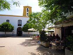 | |
 Santa Gertrudis de Fruitera Location of the village of Santa Gertrudis de Fruitera | |
| Coordinates: 38°59′52″N 1°25′42″E / 38.99778°N 1.42833°E | |
| Country |
|
| Region | Balearic Islands |
| Population (2006) | |
| • Total | 1,680 |
| Time zone | CET (UTC+1) |
| • Summer (DST) | CEST (UTC+2) |
Santa Gertrudis de Fruitera is a small village in the central region of the Spanish island of Ibiza.[1]
References
- ↑ "579 Regional Map, Spain, Islas Baleares. Pub:Michelin Editions des Voyages, 2004, ISBN 2-06-710098-X
This article is issued from Wikipedia - version of the 10/23/2015. The text is available under the Creative Commons Attribution/Share Alike but additional terms may apply for the media files.