Santana do Paraíso
| Santana do Paraíso | |||
|---|---|---|---|
|
Partial view of Santana do Paraíso | |||
| |||
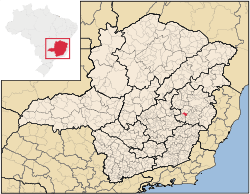 Location of Santana do Paraíso | |||
 Santana do Paraíso Location of Santana do Paraíso | |||
| Coordinates: 19°21′50″S 42°34′08″W / 19.36389°S 42.56889°WCoordinates: 19°21′50″S 42°34′08″W / 19.36389°S 42.56889°W | |||
| Country |
| ||
| Region | Southeast | ||
| State |
| ||
| Government | |||
| • Mayor | Antonio Afonso Duarte | ||
| Area | |||
| • Total | 275.529 km2 (106.382 sq mi) | ||
| Population (2010) | |||
| • Total | 27,258 | ||
| • Density | 99/km2 (260/sq mi) | ||
| Time zone | UTC-3 (UTC-3) | ||
| • Summer (DST) | UTC-2 (UTC-2) | ||
| Website | santanadoparaiso.mg.gov.br | ||


Santana do Paraíso is a Brazilian municipality situated in the state of Minas Gerais which was founded in 1992. It forms part of the Vale do Aço metropolitan area. Its estimated population in 2004 was of 20.760 inhabitants.
Before its foundation, Santana do Paraiso's location was a rest spot for people who travelled the road between the cities of Ferros and Coronel Fabriciano. The region is host to the "Cachoeiras de Taquaraçu" (Taquaraçu Waterfalls), in which horses could drink water and travellers could rest near. As time went by, people began building houses on the location, and a city was eventually established, being named Santana do Paraíso in homage to Nossa Senhora de Santana, a local saint.
Economy
The municipality is the less important and less populated of the four main cities of Vale do Aço. Even so, Santana do Paraíso has in its territory some of the region's most important services, as Usiminas Airport and the Queiroz Galvão waste treatment area, that attends the four cities.
Prefects
- Antônio Luiz - 1993
- Helvécio Matias de Oliveira - 1993~1996
- Juarez Antônio da Costa - 1997~2000
- Raimundo Anício Botelho - 2001~2004
- Joaquim Correia de Melo - 2004