Sapodilla Cayes
| Sapodilla Cayes Marine Reserve | |
|---|---|
|
IUCN category IV (habitat/species management area) | |
| Location | Gulf of Honduras |
| Nearest city | Punta Gorda[1] |
| Coordinates | 16°08′46″N 88°16′52″W / 16.146°N 88.281°WCoordinates: 16°08′46″N 88°16′52″W / 16.146°N 88.281°W[2] |
| Area | 15,618 hectares (38,590 acres) |
| Established | 1996 |
| Governing body |
|
The Sapodilla Cayes (Spanish: Cayos Zapotillos, Cayos Sapodilla or Cayos Sapote)[3] are an uninhabited atoll in the Gulf of Honduras. They are in the Toledo District of Belize.
Geography
The Sapodilla Cayes are a system of cayes, or low sandy islands, that are part of the Mesoamerican Barrier Reef System.
Facing south on Hunting Caye, with Lime Caye in the background.

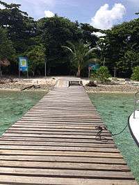
Entrance dock on Hunting Caye, to the Sapodilla Cayes Marine Reserve.
- Disputed islands
They are generally considered to be within the territorial waters of Belize, but Guatemala claims that the Belize–Guatemala maritime boundary is northwest of the cayes.[4] Honduras also lays a claim to the Sapodilla Cayes in its 1982 constitution.[3]
Marine reserve
Sapodilla Cayes Marine Reserve is a national protected marine reserve declared over the Sapodilla Cayes. It was established in 1996 and is administered by the Fisheries Department of Belize.[5]
References
- ↑ Belize Tourism Board. "Sapodilla Cayes Marine Park". Travel Belize. Retrieved 3 September 2011.
- ↑ "Sapodilla Cayes Marine Reserve". protectedplanet.net.
- 1 2 Hudson, T.; Burr, J. (1986). "The Sapodilla Cays: Geopolitical Asterisk in the Bay of Honduras". Conference of Latin Americanist Geographers. Retrieved 3 September 2011.
- ↑ Prescott, J.R.V. (1985). The Maritime Political Boundaries of the World. London: Methuen. pp. 347–350. ISBN 0-416-41750-7.
- ↑ Belize Tropical Forest Studies (2010). "Sapodilla Cayes Marine Reserve". Biodiversity and Environmental Resource Data System.
External links
| Wikimedia Commons has media related to Sapodilla Cayes. |
This article is issued from Wikipedia - version of the 11/19/2016. The text is available under the Creative Commons Attribution/Share Alike but additional terms may apply for the media files.