Sarıkavak, Çamlıyayla
| Sarıkavak | |
|---|---|
| Village | |
 | |
 Sarıkavak Location in Turkey | |
| Coordinates: 37°06′N 34°41′E / 37.100°N 34.683°ECoordinates: 37°06′N 34°41′E / 37.100°N 34.683°E | |
| Country |
|
| Province | Mersin Province |
| District | Çamlıyayla |
| Elevation | 850 m (2,830 ft) |
| Population (2012) | |
| • Total | 828 |
| Time zone | EET (UTC+2) |
| • Summer (DST) | EEST (UTC+3) |
| Postal code | 33580 |
| Area code(s) | 0324 |
| Licence plate | 33 |
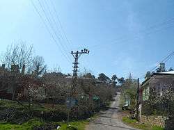
Sarıkavak is a village in Çamlıyayla district of Mersin Province, Turkey. It is on the road connecting Çamlıyayla to Tarsus and Mersin. Distance to Çamlıyayla is 17 kilometres (11 mi) to Tarsus is 40 kilometres (25 mi) and to Mersin is 69 kilometres (43 mi). The population of the town is 828 as of 2012.[1] The popular hiking course and the canyon Kisecik Canyon is to the west of the village. Sarıkavak is a typical agricultural village where vegetable and olive are the most important crops. Some residents also work in cotton fields around Tarsus, Mersin, and Adana.[2]
References
This article is issued from Wikipedia - version of the 10/26/2016. The text is available under the Creative Commons Attribution/Share Alike but additional terms may apply for the media files.