Saurpani
| Saurpani सौरपानी | |
|---|---|
| Village development committee | |
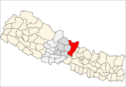
 Saurpani Location in Nepal | |
| Coordinates: 28°08′N 84°43′E / 28.14°N 84.72°ECoordinates: 28°08′N 84°43′E / 28.14°N 84.72°E | |
| Country |
|
| Zone | Gandaki Zone |
| District | Gorkha District |
| Population (2011) | |
| • Total | 5,958 |
| 2,614 Male and 3,344F emale | |
| Time zone | Nepal Time (UTC+5:75) |
| Website | http://www.saurpani.org |
Saurpani is a village development committee in Gorkha District in the Gandaki Zone of northern-central Nepal. At the time of the 2011_Nepal_census it had a population of 5,958 and had 1,325 houses in the town.
There is 24-hour electricity through mini-grids, the village can be reached by direct bus transportation from Kathmandu and form Gorkha. Saurpani is situated upon the hilltop about 1142 m (3746.72 ft) to 1900 m (6,200 ft) above sea level.
Saurpani is approximately 59.8 km away from Gorkha Palace and 68 km from Palungtar Airport. There is a gravelled road from Abu Khaireney running on the bank of Darauti River to Saurpani Bazar and another road is Ghyampeshal-Bakot-palkhu-swara-saurpani and Masel-Pandrun-Takukot-takumajh lakuribot-Saurpani.[3] [4] The village was badly affected by an earthquake on 25 April 2015.
History
there is a story how's saurapani got its name.it is told that there used to be a kuwa which is a fountain in Nepali language and a tree of saur alongside the fountain which is known for its medicinal uses.
Economy
the maximum of the population are farmers. They mainly grow maize,millet and paddy. Most of the young and energetic population are either in capital or in different countries abroad. There is a village named sundardanda which is known for its delicious and mouth watering oranges.
Tourism
before the road was made alongside river bank in daraudi river , porters,bores and traders used to take rations , provisions and the things for daily need from the hilly trail. There are no tourists except Trekkers.
School, college and hospital
Notable people form Saurpani
- Aanshu Lama, Musician / Singer
- Bishnu Bahadur Gurung, Councillor London Borough of Hounslow, Politician of Labour party London.
- Lokendra Pariyar, Bodybuilder
- Lal Bahadur Dhakal, (yogi shiva shakti nath), Yogi, Founder of Siddhashram Shakti Kendra.
- Thir Prasad Dhakal, Businessman
References
- ↑ "2011 Nepal Census" (PDF).
- ↑ "Nepal Census 2001". Nepal's Village Development Committees. Digital Himalaya. Retrieved 2008-08-31.
- ↑ "Rural Transportation Information Management System (RuTIMS)".
- ↑ "General information about Saurpani".