Scarborough Beach Road
| Scarborough Beach Road Western Australia | |
|---|---|
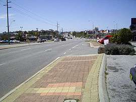 | |
| Looking east, in Innaloo | |
| General information | |
| Type | Road |
| Length | 10.2 km (6.3 mi)[1] |
| Opened | 1910s |
| Route number(s) |
|
| Major junctions | |
| Southeast end |
|
| |
| Northwest end |
|
| Location(s) | |
| Major suburbs | Mount Hawthorn, Osborne Park, Innaloo, Doubleview |
| |
Scarborough Beach Road is an arterial northwest-southeast road located in the inner northern suburbs of Perth, Western Australia. It connects North Perth to Scarborough Beach, and is mostly a single carriageway road, with two or three lanes in each direction. The road is the western section of State Route 75, between Osborne Park and Scarborough, and a short section in Innaloo is also part of State Route 64.[2]
History
North Beach Road (the original road name[3]) and was built to offer access to Osborne Park, which at the beginning of the 20th century was rural community with established agriculture including market gardens, pig farms, dairy farms, and poultry farms.[3] Whilst it was a formed road from North Perth to the corner of Frobisher Road, there was only a sand track beyond this point to Njookenbooroo, now known as Innaloo.[3] A plank road, completed in 1912, replaced this sand track, and "some years later", a limestone road extension to Brighton Road, near the coast, was built.[3] By 1925 the road had been renamed as Scarborough Beach Road, and was classified as an arterial road by Mr. Arundale, the Perth Road Board engineer in 1925.[3] By 1933, the plank roads in the area had been replaced by regular roads, but these roads were narrow and many accidents occurred due to increase in traffic associated with Scarborough Beach's rising popularity.[3] The increasing traffic meant that the road was continually being upgraded, including a partial reconstruction by the Main Roads Department in 1938.[3][4] In the 1950s, prior to the development of shopping centres at Karrinyup and Innaloo, the Mount Hawthorn section of the road was a popular shopping area.
Route Description
Scarborough Beach Road begins at Charles Street, in North Perth, as the continuation of Angove Street. The road travels north-west through Mount Hawthorn, which has been a shopping destination since the beginning of the 20th Century.[3] Axford Park, at the intersection of Oxford Street in Mount Hawthorn, is named in honour of World War I Victoria Cross recipient Thomas Axford. At Main Street, the road turns west and continues in this direction until Frobisher Street, along what was originally part of Green Street. The Glendalough railway station, built in 1992, picks up passengers on the road underneath the Mitchell Freeway bridge, in between Main Street and Frobisher Street. Scarborough Beach Road is one of only two arterial roads between Perth and Joondalup (along with Beach Road) that doesn't have an interchange with the Mitchell Freeway, although there is a "bus and taxi only" service road that is a southbound entrance ramp. Past here, the road continues north-west around Herdsman Lake, through the Osborne Park commercial centre to Innaloo. The Westfield Innaloo shopping centre, a large cinema and a tavern are located around the Odin Road/Liege Street/Ellen Stirling Boulevard intersections, which also carry traffic to the Mitchell Freeway, via Cedric Street. The Stirling railway station is located at that interchange. The road continues to travel north-west until Hancock Street, Doubleview, after which it heads west to Scarborough Beach. The last major intersection is with West Coast Highway, 100 metres (330 ft) east of its terminus.[1]
Major intersections
The following major intersections are controlled by traffic lights:[1]
-
 Charles Street (State Reoute 60) north and south / Angove Street southeast, North Perth – to Perth, Wanneroo
 -
 London Street (State Route 61) north / Loftus Street (State Route 61) south, Mount Hawthorn – to Nedlands, Joondanna
 - Oxford Street, Mount Hawthorn
-
 Green Street (State Route 75), Joondanna – to Mount Lawley
 - Main Street north / Brady Street south, Osborne Park, Glendalough and Mount Hawthorn – to Balcatta, Leederville
-
 Mitchell Freeway (State Route 2) southbound, Glendalough – no access except for buses and taxis
 - Glendalough station access
- Harborne Street south / Frobisher Street north, Osborne Park
- Hutton Street, Osborne Park – to Tuart Hill, to Mitchell Freeway (State Route 2)
- King Edward Road northbound/ Selby Street North southbound, Osborne Park
-
 Stephenson Avenue (State Route 64), Osborne Park and Innaloo – to Shenton Park
 - Ellen Stirling Boulevard, Innaloo
- Liege Street, Innaloo and Woodlands
- Odin Road (State Route 64), Innaloo – to Stirling, to Mitchell Freeway (State Route 2)
- Huntriss Road, Doubleview – to Karrinyup
- Duke Street, Scarborough – to Wembley Downs
-

 West Coast Highway (State Route 71 / Tourist Drive 204), Scarborough – to City Beach, Fremantle, Ocean Reef
See also
![]() Australian Roads portal
Australian Roads portal
References
- 1 2 3 Google (31 December 2013). "Scarborough Beach Road" (Map). Google Maps. Google. Retrieved 31 December 2013.
- ↑ Distance book (12 ed.). Main Roads Western Australia. 2012. pp. 4–5. ISBN 0 7309 7657 2. Retrieved 31 December 2013.
- 1 2 3 4 5 6 7 8 Thomas, Maud (1989). Along The Plank Road: Through Njookenbooroo to Scarborough Beach. City of Stirling. ISBN 0959881956.
- ↑ Easton, Leonard (1971). Stirling City. Stirling City Council, U.W.A. Press. p. 68.
External links
![]() Media related to Scarborough Beach Road at Wikimedia Commons
Media related to Scarborough Beach Road at Wikimedia Commons
| ||||||
| National Highways | ||||||
| National Routes | ||||||
| State Routes | ||||||
| Tourist Drives | ||||||